


A public hearing offers a chance to analyze the zoning changes proposed by the "Metro Everett" downtown plan.
"Everett has an ambitious city center planning proposal that has been circulating city hall for more than two years," reports Stephen Fesler. "Known as 'Metro Everett,' the proposal would rezone large swaths of the city center and nearby areas while pairing extensive development regulations to realize modern, integrated urban districts."
Planetizen picked up news about Metro Everett back in 2016, but the plan reached a major milestone this week when the city's Planning Commission held a public hearing on some of the code changes included in the plan. According to Fesler, "the plans have to get the commission’s buy-off before an ordinance would be transmitted to the city council for consideration."
The Planning Commission hearing means a new draft of the plan is available for perusal, resembling a draft version released in January. Fesler gives analysis of the zones proposed for the plan, Urban Mixed (UM), Urban Residential (UR), and Urban Light Industrial (ULI). According to Fesler, some of the principles applied in those zones could be extended beyong the Metro Everett boundaries into a Core residential Area overlay.
A few key characteristics of the zoning scheme put forward by metro Everett is the role of street type determining use regulations (i.e., "on TOD streets, residential uses would generally be restricted on ground floor street frontages to no more than 25% of a block (defined as 400 feet of frontage) in order to encourage active streets"). The zones also set regulations on matters of building form, like density, building heights, building locations, and ground floor spaces.
FULL STORY: Metro Everett Has A Fully-Baked Rezone Proposal, Public Hearing Tonight

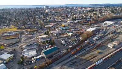
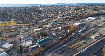
Everett's New Downtown Plan
Digging into the city of Everett's recent overhaul of its zoning and development regulations in Downtown and adjacent neighborhoods.

A New Downtown Master Plan for Everett, Washington
The city of 108,000 is preparing for major growth in the next 20 years.
Citywide Zoning Reform Approved in Everett
Few cities are accomplishing such a swift and sweeping overhaul of its land use regulations as Everett, Washington, which just wrapped up its second major planning initiative in as many years on its way to launching a third.

Maui's Vacation Rental Debate Turns Ugly
Verbal attacks, misinformation campaigns and fistfights plague a high-stakes debate to convert thousands of vacation rentals into long-term housing.

Planetizen Federal Action Tracker
A weekly monitor of how Trump’s orders and actions are impacting planners and planning in America.

In Urban Planning, AI Prompting Could be the New Design Thinking
Creativity has long been key to great urban design. What if we see AI as our new creative partner?

California Creates Housing-Focused Agency
Previously, the state’s housing and homelessness programs fell under a grabbag department that also regulates the alcohol industry, car mechanics, and horse racing.

Chicago’s Ghost Rails
Just beneath the surface of the modern city lie the remnants of its expansive early 20th-century streetcar system.

Baker Creek Pavilion: Blending Nature and Architecture in Knoxville
Knoxville’s urban wilderness planning initiative unveils the "Baker Creek Pavilion" to increase the city's access to green spaces.
Urban Design for Planners 1: Software Tools
This six-course series explores essential urban design concepts using open source software and equips planners with the tools they need to participate fully in the urban design process.
Planning for Universal Design
Learn the tools for implementing Universal Design in planning regulations.
planning NEXT
Appalachian Highlands Housing Partners
Mpact (founded as Rail~Volution)
City of Camden Redevelopment Agency
City of Astoria
City of Portland
City of Laramie