The community's hard work has helped Flint planners take an inventory of its building stock, as well as secure needed funding from the federal government.



Scott Atkinson reports on a unique participatory planning process that helped the city of Flint with some of the hard work necessary for a master planning process launched in 2012, and has since helped the city secure funding from the federal Hardest Hit fund.
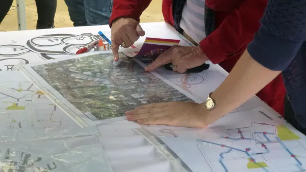
The key to the story has been community participation in a neighborhood inventory process, that helped not only identify the city's existing development strengths and weaknesses, but also helped take the message about the master plan and build trust for planning among the community.
"That first year, 2012, community-based groups inventoried the balance of residential properties" not yet inventoried by city planners, according to Atkinson.
In 2013, residents hit the streets again, this time taking inventory of the city’s commercial properties. In 2014, they updated their residential data and documented the state of the city’s streetlights. In 2015, they took inventory on sidewalks. In 2016, they turned to residential again (an every other year project), and in 2017, residential and commercial properties.
Those inventories have also been integral to helping the Genesee County Land Bank and the city of Flint secure $20.1 million from "the federal Hardest Hit Fund, a program that helps communities struggling with high foreclosure rates." According to Atkinson, "[a]s of July, Flint has received a total of about $67.5 million in Hardest Hit money. About half of that has been spent so far, resulting in the demolition of 2,248 structures."
This article is the fourth in a five-story series on resident-led revitalization efforts in Flint, Michigan.
Read the full story: Flint mapping makes city planning a team effort

Why Aren’t There More Planners?
Planning can be a great career for socially conscious individuals, but university programs are struggling to attract new students to the field. A trio of academics are raising awareness about the field through community activation.
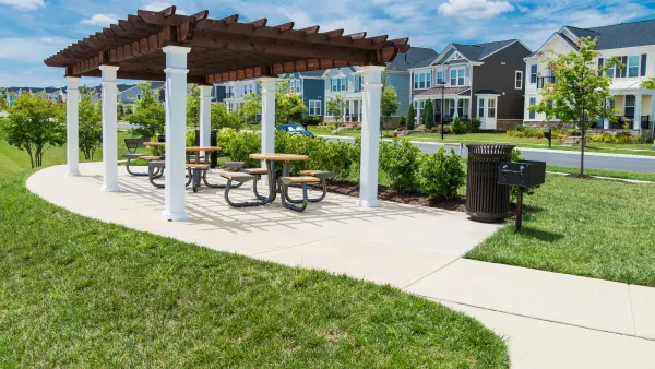
New Public Hearing Requirements Delay Completion of Reston’s New Comprehensive Plan
One of the country’s most prominent master-planned communities has spent several years working on an a comprehensive plan update. The plan will have to wait a little longer as the Fairfax County, Virginia community adjusts to new state laws.

New York City Council Wants Community Engagement to Lead Affordable Housing Development
New York Mayor Eric Adams and City Council Speaker Adrienne Adams have proposed very different responses to the city’s lack of affordable housing.

Planetizen Federal Action Tracker
A weekly monitor of how Trump’s orders and actions are impacting planners and planning in America.

Amtrak, CN end decades-long dispute with eight-year agreement
The new operating agreement establishes an updated framework for the companies to work together, including processes to resolve disputes.
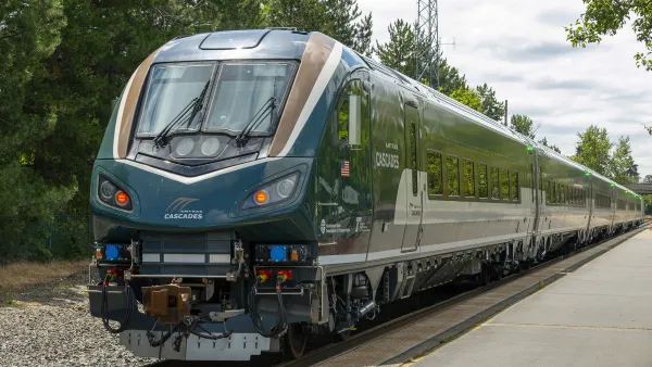
Northwest rail fans eager for Sept. 30 debut of Amtrak’s Airo fleet
Get ready for that new train smell and more seats. But they won’t go faster or run more frequently on the Cascades route in Washington and Oregon.

Brightline Florida files for bankruptcy
The transit company is over $5 billion in debt.

St. Louis Metro to test if single-car trains can reduce operating costs, maintain rider satisfaction
The pilot program will run from October to spring 2027, and begin with one single-car train operating on Metrolink’s Red and Blue lines.

Pennsylvania is building data centers in abandoned mines
Housing data centers in mines provides an alternative to destroying local forests and may spare residents from data centers’ noise and air pollution.

FREE Course: Walkable City 1: Why Walkability?
After describing his path towards focusing on walkability as the essence of good planning, Jeff Speck marches through his five principal reasons for making more walkable places.
Reinventing Malls: Planning Alchemy—Turning Gray Fields Into Gold
The course focuses on the opportunities and imperatives that shape reinvention of mall sites.

City of Thousand Oaks
City of Wisconsin Rapids
Harvard University Graduate School of Design
The Architects Foundation
University of Cincinnati Online
The Pocatello Development Authority
The Urban Renewal Agency of the City of Pocatello