


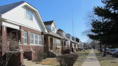
An interactive map from Chicago Cityscape shows all of the city's parking lots, vacant spaces, and city-owned land. Not all of it is truly vacant, or developable, but the map shows how much scope remains for new construction.

The folks over at Chicago Cityscape have upgraded their Property Finder map. According to founder Steven Vance, "The map's intention has always been straightforward: use open data to show all the land that is sitting there, across the city, but definitely concentrated in a few areas, waiting to be developed."
Categories of land include vacant spaces and portions of land owned by the city. The map also shows "over 4,600 parking lots, both surface and garage. Since the parking lots dataset comes from OpenStreetMap, where many individuals have drawn them in by hand, there are hundreds that have yet to be added."
Of course, not all the city-owned land is truly vacant, and neither is all the land labeled vacant. "The vacant land dataset, which comes from the Cook County Tax Assessor, is imperfect, too. It marks the space between buildings as vacant when they’re really not (used for driveways, garages, yards)."
Still, the map gives us an idea of where major infill development could occur. The majority of city-owned and vacant property is located in lower-income neighborhoods, both on the South Side (mostly west of the Dan Ryan Expressway), and west of downtown around Garfield Park and Lawndale. Parking lots are thickly spread south and west of the Loop, and along the river to the north.
FULL STORY: Look at all that developable land in the city


Chicago Planning Department Rejects 'Overparked' Six Corners Proposal
In a decision that is still impossible in most of the country, Chicago's Department of Planning and Development is requiring housing and reduced surface parking to approve a retail project.

Keeping Colorado Land from Development Could Cost $5 Million
In Golden, Colorado, residents want to keep a parcel of land as open space, but it could come with a hefty price tag.
Mapped: Chicago's Shrinking Middle Class
In 1970, half of the city's census tracts were middle-income. Now, only 16 percent of them remain so. Polarization between the well-off and the poor essentially splits the city in two.

Maui's Vacation Rental Debate Turns Ugly
Verbal attacks, misinformation campaigns and fistfights plague a high-stakes debate to convert thousands of vacation rentals into long-term housing.

Planetizen Federal Action Tracker
A weekly monitor of how Trump’s orders and actions are impacting planners and planning in America.

In Urban Planning, AI Prompting Could be the New Design Thinking
Creativity has long been key to great urban design. What if we see AI as our new creative partner?

King County Supportive Housing Program Offers Hope for Unhoused Residents
The county is taking a ‘Housing First’ approach that prioritizes getting people into housing, then offering wraparound supportive services.

Researchers Use AI to Get Clearer Picture of US Housing
Analysts are using artificial intelligence to supercharge their research by allowing them to comb through data faster. Though these AI tools can be error prone, they save time and housing researchers are optimistic about the future.

Making Shared Micromobility More Inclusive
Cities and shared mobility system operators can do more to include people with disabilities in planning and operations, per a new report.
Urban Design for Planners 1: Software Tools
This six-course series explores essential urban design concepts using open source software and equips planners with the tools they need to participate fully in the urban design process.
Planning for Universal Design
Learn the tools for implementing Universal Design in planning regulations.
planning NEXT
Appalachian Highlands Housing Partners
Gallatin County Department of Planning & Community Development
Mpact (founded as Rail~Volution)
City of Camden Redevelopment Agency
City of Astoria
City of Portland
City of Laramie