


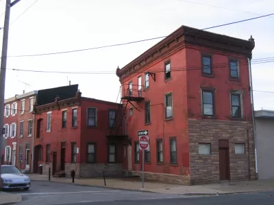
A new map-based web tool created by a former city employee calculates the redevelopment potential of every parcel in Philadelphia.
FixList compiles data from multiple city sources into a user-friendly, searchable map of Philadelphia—taking on the burden creator Stacey Mosley calls the "conflict resolution of information across departments."
Every parcel is assigned a Redevelopment Score between 0 and 100 points, using a proprietary model based on more than 50 different metrics pertaining to the property and the neighborhood. Philly Voice explains:
[The data] relates to land use of every kind: residential, commercial, or industrial. Using the website you can see how every parcel in the city is zoned, what it last sold for, who owns it, whether they are tax-delinquent (and how long they have been), as well as sales and construction trends in the surrounding neighborhood.
"I am trying to do predictive modeling to hone in on addresses that are underdeveloped in statistically significant areas that are ripe for redevelopment," Mosley tells the paper.
The wealth of data could also be useful for community groups, academics, and journalists interested in neighborhood health:
In West Philadelphia’s 19143 zip code, for instance, FixList makes visible where the 309 upcoming sheriff sales are — mostly west of 50th street, in the overwhelmingly African-American part of the area — and that 56 of those properties have been tax delinquent for more than 20 years.
On the other hand, Somerton in the Far Northeast, long a stable, white middle class section of the city, has just 15 upcoming sheriff sales, none of which have been tax delinquent for very long.
A local realtor reports that searching FixList compressed what could have been a weeklong project into about an hour of work.
It's worth noting that the resource is not a public good: a basic subscription costs $99/month.
FixList is developing databases for five other cities, which could be online by the end of next year.
FULL STORY: FixList drills down on Philadelphia homes ripe for redevelopment


How Effective are Philadelphia’s Keystone Opportunity Zones?
The impacts of a tax break designed to create jobs, stimulate development, and reduce blight are proving hard to track.

Philly Waterfront Park Breaks Ground
Penn’s Landing is an ambitious redesign of 11.5 waterfront acres.

Equitable Development Plan Aims To Protect Philly's Chinatown
As the historic neighborhood experiences increased redevelopment around the new Rail Park, community activists are working to ensure older residents and businesses aren't displaced in the process.

Maui's Vacation Rental Debate Turns Ugly
Verbal attacks, misinformation campaigns and fistfights plague a high-stakes debate to convert thousands of vacation rentals into long-term housing.

Planetizen Federal Action Tracker
A weekly monitor of how Trump’s orders and actions are impacting planners and planning in America.

In Urban Planning, AI Prompting Could be the New Design Thinking
Creativity has long been key to great urban design. What if we see AI as our new creative partner?

King County Supportive Housing Program Offers Hope for Unhoused Residents
The county is taking a ‘Housing First’ approach that prioritizes getting people into housing, then offering wraparound supportive services.

Researchers Use AI to Get Clearer Picture of US Housing
Analysts are using artificial intelligence to supercharge their research by allowing them to comb through data faster. Though these AI tools can be error prone, they save time and housing researchers are optimistic about the future.

Making Shared Micromobility More Inclusive
Cities and shared mobility system operators can do more to include people with disabilities in planning and operations, per a new report.
Urban Design for Planners 1: Software Tools
This six-course series explores essential urban design concepts using open source software and equips planners with the tools they need to participate fully in the urban design process.
Planning for Universal Design
Learn the tools for implementing Universal Design in planning regulations.
planning NEXT
Appalachian Highlands Housing Partners
Mpact (founded as Rail~Volution)
City of Camden Redevelopment Agency
City of Astoria
City of Portland
City of Laramie