


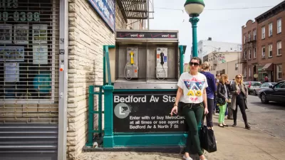
A fun, if not conclusive, exercise in layering the country's most famous transit map with data from the real estate market.

"You can pay up to $845 less per month by adding one extra subway stop and 2 minutes more to your daily commute," reports Nicole Levy.
That information comes via a new study by the apartment rental listings website RentHop, which warrants caution, given how much data is missing from RentHop's portrayal of the city's rental market.
RentHop's data does, however, reveal interesting patterns of rental disparity of along transit lines. Levy shares the headlines:
…the city's most expensive one-bedroom rentals can be found near the 23rd Street station on the 1 line, where the median price is $4,000 a month.
The most affordable are in the Bronx on the 5 and 6 lines, where the median is $1,250 near the Gun Hill Road and Pelham Bay Park stations.
All of RentHop's findings are laid out in an infographic that could distract the attention of those interested in real estate and transit for hours.
FULL STORY: See Which Subway Station Is Closest to the Cheapest Apartments

Report: L Train Closure Finally Impacting the Brooklyn Real Estate Market
The New York MTA is planning to shut down the L Train from Brooklyn to Manhattan in 2019, and renters in the area no longer find the area along the route as attractive.

Rents Falling at the Upper End of New York's Real Estate Market
The construction of thousands of rental apartments in Manhattan, Brooklyn, and Queens are credited with driving down costs at the upper end of the New York City rental market.
New York Subway Reaches One Billion Ride Milestone
The system’s 2024 performance is on track for its fastest growth since the pandemic.

Rethinking Redlining
For decades we have blamed 100-year-old maps for the patterns of spatial racial inequity that persist in American cities today. An esteemed researcher says: we’ve got it all wrong.

Planetizen Federal Action Tracker
A weekly monitor of how Trump’s orders and actions are impacting planners and planning in America.

California High-Speed Rail's Plan to Right Itself
The railroad's new CEO thinks he can get the project back on track. The stars will need to align this summer.

US Senate Reverses California EV Mandate
The state planned to phase out the sale of gas-powered cars by 2035, a goal some carmakers deemed impossible to meet.

Trump Cuts Decimate Mapping Agency
The National Geodetic Survey maintains and updates critical spatial reference systems used extensively in both the public and private sectors.

Washington Passes First US ‘Shared Streets’ Law
Cities will be allowed to lower speed limits to 10 miles per hour and prioritize pedestrians on certain streets.
Urban Design for Planners 1: Software Tools
This six-course series explores essential urban design concepts using open source software and equips planners with the tools they need to participate fully in the urban design process.
Planning for Universal Design
Learn the tools for implementing Universal Design in planning regulations.
City of Camden Redevelopment Agency
City of Astoria
Transportation Research & Education Center (TREC) at Portland State University
Regional Transportation Commission of Southern Nevada
Toledo-Lucas County Plan Commissions