


Jody Avirgan shares insight into a new podcast with the creators of the new Pixar movie The Good Dinosaur, which reads like more of an advertisement for the U.S. Geological Survey (USGS).
A 30-minute "What's the Point" podcast puts host Jody Avirgan in conversation with David Munier, set supervisor for the new Pixar film The Good Dinosaur. A clip introducing the podcast quotes Munier describing the environment as the antagonist in the film, requiring a higher degree of realism than a completely fantasy world often offers. Avirgan describes the role of the USGS in making the landscapes come to life:
"Pixar used actual U.S. Geological Survey information to render the landscapes that Arlo and Spot (the titular dinosaur and his pet human) traipse around in. This data allowed the animators to re-create actual mountains, streams and horizons, which in turn let director Pete Sohn compose the wide-open shots he was looking for."
Part of the podcast's fascination with the film is the amount of data that the film used—one scene, for instance, used as much data as the entirety of the 2011 film Cars 2.
Also included in the podcast is a conversation between Derrick Clements of "The Pixar Podcast" and Mike Tischler, director of the USGS National Geospatial Program, about how the USGS gathers data.
FULL STORY: The Dream World Of ‘The Good Dinosaur’ Is Based On USGS Surveys


USGS Water Science Centers Targeted for Closure
If their work is suspended, states could lose a valuable resource for monitoring, understanding, and managing water resources.
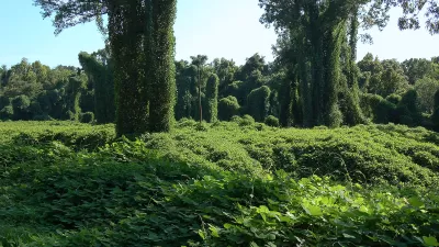
Finding New Uses for the 'Vine That Ate the South'
Visually striking and aggressively invasive, kudzu has been choking the Southeast for decades. Now, designers, chefs, and activists want to find ways to make it useful.

Where the Ground Sinks Under the Weight of Development
New research documents how the weight of buildings causes the ground to sink underneath developments in the San Francisco Bay Area.

Maui's Vacation Rental Debate Turns Ugly
Verbal attacks, misinformation campaigns and fistfights plague a high-stakes debate to convert thousands of vacation rentals into long-term housing.

Planetizen Federal Action Tracker
A weekly monitor of how Trump’s orders and actions are impacting planners and planning in America.

In Urban Planning, AI Prompting Could be the New Design Thinking
Creativity has long been key to great urban design. What if we see AI as our new creative partner?

How Trump's HUD Budget Proposal Would Harm Homelessness Response
Experts say the change to the HUD budget would make it more difficult to identify people who are homeless and connect them with services, and to prevent homelessness.

The Vast Potential of the Right-of-Way
One writer argues that the space between two building faces is the most important element of the built environment.

Florida Seniors Face Rising Homelessness Risk
High housing costs are pushing more seniors, many of them on a fixed income, into homelessness.
Urban Design for Planners 1: Software Tools
This six-course series explores essential urban design concepts using open source software and equips planners with the tools they need to participate fully in the urban design process.
Planning for Universal Design
Learn the tools for implementing Universal Design in planning regulations.
Gallatin County Department of Planning & Community Development
Heyer Gruel & Associates PA
JM Goldson LLC
City of Camden Redevelopment Agency
City of Astoria
Transportation Research & Education Center (TREC) at Portland State University
Jefferson Parish Government
Camden Redevelopment Agency
City of Claremont