


The diffuse structure of suburbs makes it more efficient, according to this Brooking Institution post, to invest in individuals rather than places to fight poverty.
Natalie Holmes and Alan Berube explains some of the implications of a shifting geography of poverty—from urban to suburban—and its connections to the federal Earned Income Tax Credit (EITC). Now that the geography of poverty is shifting, according to the article, so too will the role of the EITC. Moreover, the article also explains "how expanding participation in the program and paying the credit differently could enhance its effectiveness as a local economic stabilizer."
The article establishes the historical context for the War on Poverty, dating back to 1964, when poverty was mostly urban and rural. Poverty in suburban settings, however, will make place-based initiatives harder to achieve. Therefore, direct investments in low-income individuals, such as the EITC, will become more important.
That's not to say that the EITC fails to benefit a broader definition of community, according to the post. California State University researchers cited in the article found evidence that "the credit creates local economic impacts equivalent to at least twice the amount of EITC dollars received" in California counties. Other examples of the community and multi-generational benefits of the EITC are included in the article.
The article concludes with additional recommendations for how to maximize the EITC as an anti-poverty tool in suburban settings.
FULL STORY: The Earned Income Tax Credit and Community Economic Stability

How Transportation Assistance Can Fight Homelessness
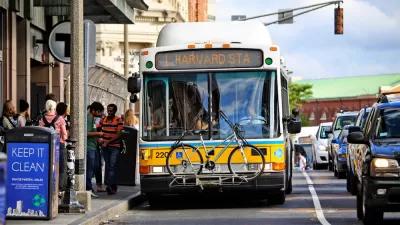
Transportation access is one of the biggest factors in keeping people out of homelessness. Cities can help with discounted fares and last-mile connections.

Looking for the Causes of Suburban Poverty
Why is poverty increasing in the suburbs? It's not as simple as blaming the shifting demographics of the urban core.

Responses to the Suburbanization of Poverty in Short Supply
Low-income residents have scattered to the periphery, where social services are less accessible.

Montreal Mall to Become 6,000 Housing Units
Place Versailles will be transformed into a mixed-use complex over the next 25 years.

Planetizen Federal Action Tracker
A weekly monitor of how Trump’s orders and actions are impacting planners and planning in America.

DARTSpace Platform Streamlines Dallas TOD Application Process
The Dallas transit agency hopes a shorter permitting timeline will boost transit-oriented development around rail stations.

Study: 4% of Truckers Lack a Valid Commercial License
Over 56% of inspected trucks had other violations.

Chicago Judge Orders Thousands of Accessible Ped Signals
Only 3% of the city's crossing signals are currently accessible to blind pedestrians.

Philadelphia Swaps Car Lanes for Bikeways in Unanimous Vote
The project will transform one of the handful of streets responsible for 80% of the city’s major crashes.
Urban Design for Planners 1: Software Tools
This six-course series explores essential urban design concepts using open source software and equips planners with the tools they need to participate fully in the urban design process.
Planning for Universal Design
Learn the tools for implementing Universal Design in planning regulations.
City of Mt Shasta
City of Camden Redevelopment Agency
City of Astoria
Transportation Research & Education Center (TREC) at Portland State University
US High Speed Rail Association
City of Camden Redevelopment Agency
Municipality of Princeton (NJ)