


"Portlandness: A Cultural Atlas" exemplifies the powers of maps to reshape and redefine our communities. Just watch how they can change expectations about the culture of the city infamously known as "Portlandia."

Steve Duin reports on a new book by Hunter Shobe, called Portlandness: A Cultural Atlas. The book is guided by the principle that "we have unique ways to illustrate the city's enduring and evolving space."
Among the maps included in the book: a map of all the surveillance cameras in the city, and "path of least surveillance" through them all. It also "maps ghost sightings, the most treacherous sidewalks in the Pearl, the city's original ethnic enclaves, the red-lining of Alberta, and the impact of surging property values along North Mississippi Avenue."
Also included in the book is a map created by a class of third graders from Jason Lee K-8. The class selected 82nd Avenue as the center of the city—an area that isn't really on the map for most Portlanders, but for these students, "it's an area rich in meaning," explains Shobe in the article. Shobe adds: "It forces us to re-imagine a place we think we know really well."
FULL STORY: Steve Duin: The coolest maps of Portland you've ever seen


Mapping the Pacific Northwest's Changing Population
The Oregonian has published a new interactive mapping feature that allows users to map demographic changes to the Census tract level through Oregon and Washington.
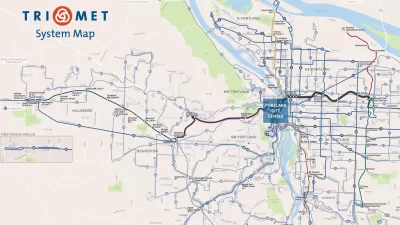
How to Design a Better Bus Transit Map
Not all transit maps are created equal. The new Portland TriMet map, for instance, does a much better job of illustrating the usefulness of its high-frequency network.

Portland Housing Bond Created Nearly 5,000 Units, But Affordability Remains Out of Reach
Despite better-than-expected results from multiple local housing bonds, housing costs and homelessness remain top of mind for many Oregonians.

Planetizen Federal Action Tracker
A weekly monitor of how Trump’s orders and actions are impacting planners and planning in America.

Maui's Vacation Rental Debate Turns Ugly
Verbal attacks, misinformation campaigns and fistfights plague a high-stakes debate to convert thousands of vacation rentals into long-term housing.

San Francisco Suspends Traffic Calming Amidst Record Deaths
Citing “a challenging fiscal landscape,” the city will cease the program on the heels of 42 traffic deaths, including 24 pedestrians.

Defunct Pittsburgh Power Plant to Become Residential Tower
A decommissioned steam heat plant will be redeveloped into almost 100 affordable housing units.

Trump Prompts Restructuring of Transportation Research Board in “Unprecedented Overreach”
The TRB has eliminated more than half of its committees including those focused on climate, equity, and cities.

Amtrak Rolls Out New Orleans to Alabama “Mardi Gras” Train
The new service will operate morning and evening departures between Mobile and New Orleans.
Urban Design for Planners 1: Software Tools
This six-course series explores essential urban design concepts using open source software and equips planners with the tools they need to participate fully in the urban design process.
Planning for Universal Design
Learn the tools for implementing Universal Design in planning regulations.
Heyer Gruel & Associates PA
JM Goldson LLC
Custer County Colorado
City of Camden Redevelopment Agency
City of Astoria
Transportation Research & Education Center (TREC) at Portland State University
Jefferson Parish Government
Camden Redevelopment Agency
City of Claremont