


Modern maps are visual representations of millions of points of standardized data.
"As rapid change and urbanization redraw the world, someone must refresh our maps so that the two-dimensional pictures that give us a common sense of where we live reflect the dynamic, shape-shifting places around us," Emily Badger writes.
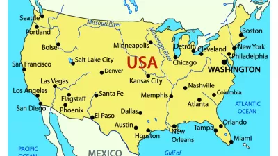
Over 12,000 new place names were identified in the United States last year, including natural landmarks, such as basins or cliffs, infrastructure, such as crossings and hospitals, and municipalities, such as newly incorporated cities. In the course of just four months this year, over 57,000 new place names in China were identified, standardized, and added to the U.S. government's database of foreign places. These data are maintained by the Board of Geographic Names (BGN), a 125-year old agency tasked with ensuring consistent spelling, transliteration, and description of the place.
As the world's population grows and expands it's terrestrial footprint, the BGN acquires information—sometimes conflicting—about the names, features, and locations of newly identified places, and these data are used to update maps.
The BGN website explains: "The original program of names standardization addressed the complex issues of domestic geographic feature names during the surge of exploration, mining, and settlement of western territories after the American Civil War. Inconsistencies and contradictions among many names, spellings, and applications became a serious problem to surveyors, map makers, and scientists who required uniform, non-conflicting geographic nomenclature." Such problems still occur for places in countries that don't have well-developed cartographic services, such as Afghanistan, or in countries where spellings and transliterations vary across regions and languages.
A quick search for the places in California containing the word "calhoun" returns one canal in Solano County, identified in 1981 as “Calhoun Cut.” A search for lakes in Minnesota crashes the computer. According to the database, there are 32 arches in Missouri, though none appear to be the iconic Gateway Arch of Saint Louis. That's because the monument does not fit the official definition of an arch, which is "a natural arch-like opening in a rock mass." By BGN standards, the 630-foot landmark is technically a park.
Badger explains why this agency's responsibilities are so critical. "Imagine the Army and the Marine Corps talking about the same town with different names in Afghanistan. Or what would happen if no one could agree on what to call Mount Hood. Or how you'd find Reston if no one had ever added it to a map."
FULL STORY: How official mapmakers keep up with a world that won’t stand still


Four New Map Books Reviewed
Looking for the perfect holiday gift for a planner? Check out these new map books.
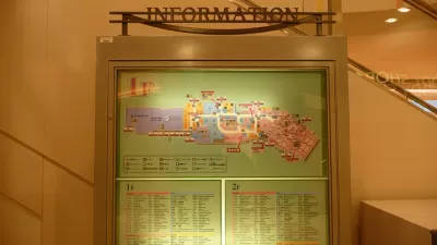
The Future of Mapping is Going Indoors
Cartographers have a new world to map, as technology opens up the interiors of malls, museums, and other large spaces to online exploration.

Visualizing the Coronavirus Pandemic
Mapping of the crisis is producing a fascinating and important trove of cartographic records.

Planetizen Federal Action Tracker
A weekly monitor of how Trump’s orders and actions are impacting planners and planning in America.

Maui's Vacation Rental Debate Turns Ugly
Verbal attacks, misinformation campaigns and fistfights plague a high-stakes debate to convert thousands of vacation rentals into long-term housing.

San Francisco Suspends Traffic Calming Amidst Record Deaths
Citing “a challenging fiscal landscape,” the city will cease the program on the heels of 42 traffic deaths, including 24 pedestrians.

Amtrak Rolls Out New Orleans to Alabama “Mardi Gras” Train
The new service will operate morning and evening departures between Mobile and New Orleans.

The Subversive Car-Free Guide to Trump's Great American Road Trip
Car-free ways to access Chicagoland’s best tourist attractions.

San Antonio and Austin are Fusing Into one Massive Megaregion
The region spanning the two central Texas cities is growing fast, posing challenges for local infrastructure and water supplies.
Urban Design for Planners 1: Software Tools
This six-course series explores essential urban design concepts using open source software and equips planners with the tools they need to participate fully in the urban design process.
Planning for Universal Design
Learn the tools for implementing Universal Design in planning regulations.
Heyer Gruel & Associates PA
JM Goldson LLC
Custer County Colorado
City of Camden Redevelopment Agency
City of Astoria
Transportation Research & Education Center (TREC) at Portland State University
Jefferson Parish Government
Camden Redevelopment Agency
City of Claremont