


Newly released population data provides entre for a discussion about the nature of cities.

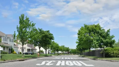
Following on this week's big reveal of the updated U.S. Census population estimates for 2014, Jed Kolko digs into the data to reveal a trait common on among many of the country's fastest growing "cities": they're actually more like suburbs. In fact, according to Kolko's analysis, three of the ten largest cities in the country are actually more suburban than urban (viz., Phoenix, San Antonio, and San Diego).
Kolko notes that a lack of a clear distinction between suburban and urban lends ambiguity to the Census population data. To place the findings in a more useful context, Kolko uses a definition reached by a survey performed by Trulia.
"Our analysis showed that the single best predictor of whether someone said his or her area was urban, suburban or rural was ZIP code density. Residents of ZIP codes with more than 2,213 households per square mile typically described their area as urban. Residents of neighborhoods with 102 to 2,213 households per square mile typically called their area suburban. In ZIP codes with fewer than 102 households per square mile, residents typically said they lived in a rural area.2 The density cutoff we found between urban and suburban — 2,213 households per square mile — is roughly equal to the density of ZIP codes 22046 (Falls Church in Northern Virginia); 91367 (Woodland Hills in California’s San Fernando Valley); and 07666 (Teaneck, New Jersey)."
From this analysis comes a few interesting conclusions, such as a case for the uniquely urban qualities of New York and the surprisingly urban qualities of Los Angeles. Also, many of the fastest growing cities in the country are surprisingly suburban. According to Kolko, "[a]mong the 10 fastest-growing cities with more than 500,000 people, five — Austin, Fort Worth, Charlotte, San Antonio and Phoenix — are majority suburban, and a sixth, Las Vegas, is only 50 percent urban. Only one of the 10 fastest-growing, Seattle, is at least 90 percent urban."
FULL STORY: How Suburban Are Big American Cities?

New Census Data Confirms: Suburban Areas Lead U.S. Growth
Post-recession population growth in the United States looks a lot like pre-recession growth in the United States. As some have predicted or already noticed: the story of U.S. growth is still suburban.

U.S. Census Releases 2014 Population Estimates
The U.S. Census Bureau's 2014 population estimates shows persistent trends of growth in the Sun Belt along with a few other noteworthy data points.

For 2020 Census, Cities Face Hurdles Finding People to Count
In many cities, people are living in places that are hard to locate. But accurate census counts are crucial to ensuring cities get their fair share of political power and funding.

Maui's Vacation Rental Debate Turns Ugly
Verbal attacks, misinformation campaigns and fistfights plague a high-stakes debate to convert thousands of vacation rentals into long-term housing.

Planetizen Federal Action Tracker
A weekly monitor of how Trump’s orders and actions are impacting planners and planning in America.

In Urban Planning, AI Prompting Could be the New Design Thinking
Creativity has long been key to great urban design. What if we see AI as our new creative partner?

Cal Fire Chatbot Fails to Answer Basic Questions
An AI chatbot designed to provide information about wildfires can’t answer questions about evacuation orders, among other problems.

What Happens if Trump Kills Section 8?
The Trump admin aims to slash federal rental aid by nearly half and shift distribution to states. Experts warn this could spike homelessness and destabilize communities nationwide.

Sean Duffy Targets Rainbow Crosswalks in Road Safety Efforts
Despite evidence that colorful crosswalks actually improve intersection safety — and the lack of almost any crosswalks at all on the nation’s most dangerous arterial roads — U.S. Transportation Secretary Duffy is calling on states to remove them.
Urban Design for Planners 1: Software Tools
This six-course series explores essential urban design concepts using open source software and equips planners with the tools they need to participate fully in the urban design process.
Planning for Universal Design
Learn the tools for implementing Universal Design in planning regulations.
Appalachian Highlands Housing Partners
Gallatin County Department of Planning & Community Development
Heyer Gruel & Associates PA
Mpact (founded as Rail~Volution)
City of Camden Redevelopment Agency
City of Astoria
City of Portland
City of Laramie