


A new trail segment along the Los Angeles River breaks ground in a park-poor neighborhood as part of the countywide Los Angeles River revitalization.
With decades-old efforts to return the 51-mile Los Angeles River to green space gaining traction, ensuring that communities along the waterway benefit equitably has been a challenge. Community Conservation Solutions and its partners are working to bring the San Fernando Valley its share. A segment of river trail there will soon connect existing paths to create a five-mile continuous stretch, bringing recreational amenities and urban nature to residents.
The Planning Report sat down with Esther Feldman of Community Conservation Solutions and Mia Lehrer of Mia Lehrer and Associates to discuss the significance of this greenway project to the region: "The Valley is one of the most park-poor places in the State of California, well below the averages that the National Recreation and Parks Association recommends: 6-10 acres of easily accessible open space for every 1,000 people. By creating these linear greenways in the Valley, we’re shining a spotlight on the need for river trails in other places around the county."
Feldman, who has championed Los Angeles River revitalization since 1994, went on to discuss the transformational aspects of nature and the significance of natural ecosystems within urban spaces: "It never fails to amaze me when I walk along the LA River, and particularly this section, that it’s half a block from Ventura Boulevard—one of the busiest thoroughfares in the county. And yet, it is quiet and peaceful at the river. There you are, watching red tail hawks soar and egrets fly by, with ducks on the water… By building these segments of river trails that connect, we really make it possible to 'come down to the river.'"
FULL STORY: Zev Yaroslavsky LA River Greenway Trail: The Valley's 'Missing Link'

San Fernando Valley Pushes Metro to Address Transit Needs
Built for industry and known for sprawl, the Valley has long preserved its suburban geography. Now that its population is close to 40 percent of the city of Los Angeles, area leaders are speaking up for mass transit.
A Political Victory to Protect Wild Coastal Land
Los Angeles County Supervisor Zev Yaroslavsky discusses how the approval of new plans will preserve a stretch of unincorporated Southern California coastline.
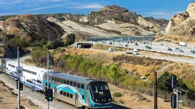
Train Service Expands to Northern Los Angeles County
The added Metrolink service will improve the public transportation system’s accessibility and availability for riders across the Antelope, Santa Clarita, and San Fernando valleys.

Maui's Vacation Rental Debate Turns Ugly
Verbal attacks, misinformation campaigns and fistfights plague a high-stakes debate to convert thousands of vacation rentals into long-term housing.

Planetizen Federal Action Tracker
A weekly monitor of how Trump’s orders and actions are impacting planners and planning in America.

In Urban Planning, AI Prompting Could be the New Design Thinking
Creativity has long been key to great urban design. What if we see AI as our new creative partner?

King County Supportive Housing Program Offers Hope for Unhoused Residents
The county is taking a ‘Housing First’ approach that prioritizes getting people into housing, then offering wraparound supportive services.

Researchers Use AI to Get Clearer Picture of US Housing
Analysts are using artificial intelligence to supercharge their research by allowing them to comb through data faster. Though these AI tools can be error prone, they save time and housing researchers are optimistic about the future.

Making Shared Micromobility More Inclusive
Cities and shared mobility system operators can do more to include people with disabilities in planning and operations, per a new report.
Urban Design for Planners 1: Software Tools
This six-course series explores essential urban design concepts using open source software and equips planners with the tools they need to participate fully in the urban design process.
Planning for Universal Design
Learn the tools for implementing Universal Design in planning regulations.
planning NEXT
Appalachian Highlands Housing Partners
Mpact (founded as Rail~Volution)
City of Camden Redevelopment Agency
City of Astoria
City of Portland
City of Laramie