


The legalization (or illegalization) process of Uber throughout the country allows city governments to leverage a data exchange with the company, but too many municipalities are passing up this momentous opportunity.
Last week Washington D.C. passed legislation legalizing services such as Uber and Lyft. However, according to Emily Badger of the Washington Post, the city missed a huge opportunity to better understand the movement of its residents and hold these private companies accountable by not demanding access to privatized passenger trips taken (and canceled).
As Badger writes, the vast amounts of anonymized data collected by Uber protecting both drivers and riders, "would help cities verify that Uber drivers aren't discriminating against certain neighborhoods or disabled passengers, that Uber is actually weeding out drivers who do, that the company is truly serving the public in exchange for the public's confidence in it."
In addition to greater amounts of accountability, the data would be particularly useful for "transportation planners, who spend a lot of time (and money) trying to understand the travel patterns of residents that are already passively captured by transportation apps. Uber is building a sophisticated picture of how people move around many cities — where the demand is, where people want to go, when those trips take place down to the minute... it could also help cities plan infrastructure, manage traffic flow, and understand commuters better."
FULL STORY: Uber’s data could be a treasure trove for cites. But they’re wasting the chance to get it.


Gig Workers Demand Data Transparency
Access to data for gig workers can provide a valuable source of information and bargaining power in a traditionally opaque and risky industry.
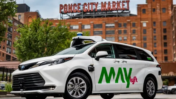
Atlanta, Dallas Area to Launch Robotaxi Rideshare Fleets
Lyft and Uber will begin including autonomous vehicles in their networks in Atlanta and Arlington, Texas starting later this year.

Minnesota Lawmakers Reach Ride Share Compromise
A law awaiting the governor’s signature establishes wage rates for drivers. Ride share companies say if the law passes, they plan to continue service in the state.

Planetizen Federal Action Tracker
A weekly monitor of how Trump’s orders and actions are impacting planners and planning in America.

Chicago’s Ghost Rails
Just beneath the surface of the modern city lie the remnants of its expansive early 20th-century streetcar system.

Amtrak Cutting Jobs, Funding to High-Speed Rail
The agency plans to cut 10 percent of its workforce and has confirmed it will not fund new high-speed rail projects.

Ohio Forces Data Centers to Prepay for Power
Utilities are calling on states to hold data center operators responsible for new energy demands to prevent leaving consumers on the hook for their bills.

MARTA CEO Steps Down Amid Citizenship Concerns
MARTA’s board announced Thursday that its chief, who is from Canada, is resigning due to questions about his immigration status.

Silicon Valley ‘Bike Superhighway’ Awarded $14M State Grant
A Caltrans grant brings the 10-mile Central Bikeway project connecting Santa Clara and East San Jose closer to fruition.
Urban Design for Planners 1: Software Tools
This six-course series explores essential urban design concepts using open source software and equips planners with the tools they need to participate fully in the urban design process.
Planning for Universal Design
Learn the tools for implementing Universal Design in planning regulations.
Caltrans
City of Fort Worth
Mpact (founded as Rail~Volution)
City of Camden Redevelopment Agency
City of Astoria
City of Portland
City of Laramie