


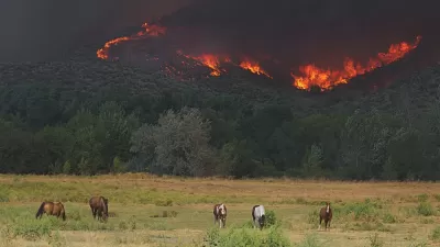
WIFIRE, a real-time and data-driven simulation, prediction, and visualization technology, combines satellite and remote sensor data to forecast the potential spread of wildfires.
As InformationWeek reports, a team of researchers, technologists, and firefighters from the University of California at San Diego and the University of Maryland, with support from the National Science Foundation, have come together to create a far-reaching simulation, visualization, and prediction model for understanding wildfires called WIFIRE. Although still partially in development, WIFIRE has some prototypes and pilot applications now available.
Once completed, WIFIRE will be a vast open network with specialized interfaces and messages sent to receivers. Indeed, according to Elena Malykhina, "having such infrastructure in place would be especially useful during massive environmental events like the wildfires that California firefighters have been battling."
With summer wildfires expected to increase in the next 50 years, WIFIRE is a high-resolution, life-saving data tool with the potential to understand the patterns of wildfires.
FULL STORY: Big Data Tackles Wildfire Control

Wildfires Prompt Forestry Debate on Climate Change
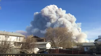
While forests sequester atmospheric carbon dioxide, wildfires release enormous amounts of greenhouse gases as they increase in frequency and intensity from climate change.

Study: Forest Fires Have Doubled in the Western United States
Wildfires ravaged the western United States again this year, reflecting the new normal of climate change.
Thank Climate Change and Sprawl for Worsening Wildfires
Along with climate conditions, urban sprawl is intensifying wildfires and increasing the damage they do.

Planetizen Federal Action Tracker
A weekly monitor of how Trump’s orders and actions are impacting planners and planning in America.

Chicago’s Ghost Rails
Just beneath the surface of the modern city lie the remnants of its expansive early 20th-century streetcar system.

San Antonio and Austin are Fusing Into one Massive Megaregion
The region spanning the two central Texas cities is growing fast, posing challenges for local infrastructure and water supplies.

Since Zion's Shuttles Went Electric “The Smog is Gone”
Visitors to Zion National Park can enjoy the canyon via the nation’s first fully electric park shuttle system.

Trump Distributing DOT Safety Funds at 1/10 Rate of Biden
Funds for Safe Streets and other transportation safety and equity programs are being held up by administrative reviews and conflicts with the Trump administration’s priorities.

German Cities Subsidize Taxis for Women Amid Wave of Violence
Free or low-cost taxi rides can help women navigate cities more safely, but critics say the programs don't address the root causes of violence against women.
Urban Design for Planners 1: Software Tools
This six-course series explores essential urban design concepts using open source software and equips planners with the tools they need to participate fully in the urban design process.
Planning for Universal Design
Learn the tools for implementing Universal Design in planning regulations.
planning NEXT
Appalachian Highlands Housing Partners
Mpact (founded as Rail~Volution)
City of Camden Redevelopment Agency
City of Astoria
City of Portland
City of Laramie