


The city of Springdale, Arkansas is hoping to leverage plans for the Razorback Greenway into a downtown revival.
Like a lot of other cites Springfield has grown outwards, according to an article by Matt Cook, but hopes for economic development in its downtown hinge on a 36-mile multiuse trail connecting Fayetteville and Bella Vista, which passes through town alongside Spring Creek.
Here's how Cook describes the difference the Razorback Greenway makes: "The opening later this year of a Walmart Supercenter on the west end of town by Interstate 49 has stirred economic development interest there. Downtown Springdale is also seeing activity, not because of a Walmart but because of the Razorback Greenway."
Planning efforts are already anticipating the trail's opening: "The city’s master plan calls for about $20.5 million in improvements to coincide with the opening of the trail later this year."
Moreover, "Springdale also has Spring Creek running through downtown, and the city has made plans to 'uncap' the stream. The creek was channeled through an underground culvert to control flooding and now travels under downtown, but the city envisions free-flowing water with a park setting alongside the greenway trailhead."
FULL STORY: Trail Boosts Springdale's Downtown Effort

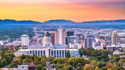
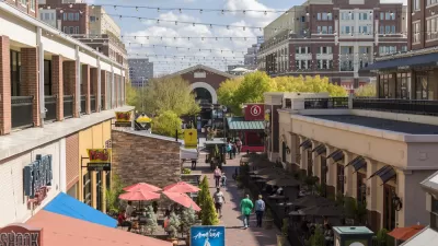
Salt Lake City Bucks Downtown Decline Trend
The city’s central business district is bustling with more activity than before the pandemic.
Debating Public Incentives for Private Developments
A debate common in growing cities around the country is taking place in Atlanta in answer to the question of how much support private developers need from the public.
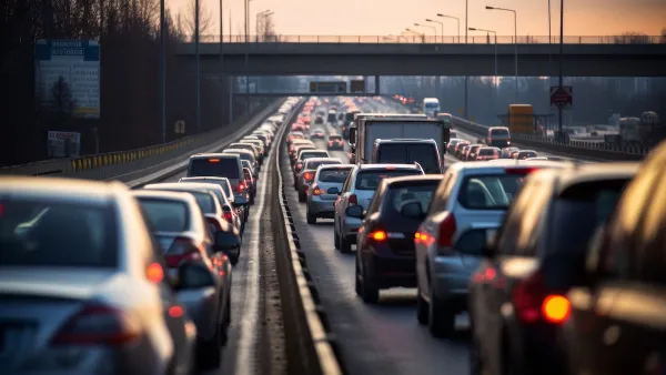
The Mobility-Productivity Paradox
New research shows that excessive vehicle travel reduces economic productivity, and that less mobility provides more productivity. Yes, you read that right.

Planetizen Federal Action Tracker
A weekly monitor of how Trump’s orders and actions are impacting planners and planning in America.

Maui's Vacation Rental Debate Turns Ugly
Verbal attacks, misinformation campaigns and fistfights plague a high-stakes debate to convert thousands of vacation rentals into long-term housing.

San Francisco Suspends Traffic Calming Amidst Record Deaths
Citing “a challenging fiscal landscape,” the city will cease the program on the heels of 42 traffic deaths, including 24 pedestrians.

Amtrak Rolls Out New Orleans to Alabama “Mardi Gras” Train
The new service will operate morning and evening departures between Mobile and New Orleans.

The Subversive Car-Free Guide to Trump's Great American Road Trip
Car-free ways to access Chicagoland’s best tourist attractions.

San Antonio and Austin are Fusing Into one Massive Megaregion
The region spanning the two central Texas cities is growing fast, posing challenges for local infrastructure and water supplies.
Urban Design for Planners 1: Software Tools
This six-course series explores essential urban design concepts using open source software and equips planners with the tools they need to participate fully in the urban design process.
Planning for Universal Design
Learn the tools for implementing Universal Design in planning regulations.
Heyer Gruel & Associates PA
JM Goldson LLC
Custer County Colorado
City of Camden Redevelopment Agency
City of Astoria
Transportation Research & Education Center (TREC) at Portland State University
Jefferson Parish Government
Camden Redevelopment Agency
City of Claremont