


Columbia University's Cloud Lab aims to measure participants' brainwaves and figure out their state of mind of as they experience their surroundings.
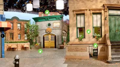
Sarah Goodyear reports on her personal experience as a participant for a "brain-imaging experiment," run by Mark Collins of Columbia University's Cloud Lab. In the study, which Collins describes as "more of a large-scale art project" than scientific research, participants were asked to wear a NeuroSky device (similar to a Google Glass) to measure brain waves as they walked around New York's Dumbo neighborhood.
Goodyear summarizes the experiment: "The NeuroSky device…takes readings of the brain’s electrical activity…An algorithm then…summarizes them into two general states – attentive and meditative. The idea behind the visualization will be to 'spray' this data onto a 3D map of the neighborhood we walked around and see what it reveals about the mental state of the experiment’s participants as they moved through space."
The experiment aims "to monitor our brain waves, hoping to harness the resulting data to better comprehend how human beings interact with their urban and architectural environments." In this way, Collins hopes to gather data that will be used "when we design cities or neighborhoods or when we make decisions about the urban experiences we want to pursue."
The article does not describe how a "meditative" or "attentive" state of mind will be interpreted to inform urban design or policy. In the near future, though, we may see brain wave measuring devices that help us capture insights about urban design perception that is too subtle for words or observation.
FULL STORY: The Quest to Measure the Brain's Response to Urban Design

‘Architectural Epidemiology:’ Centering Public Health in Urban Design
A new book asks, what if cities were designed around health equity?
The Vast Potential of the Right-of-Way
One writer argues that the space between two building faces is the most important element of the built environment.

How Public Spaces Exclude Teen Girls
Adolescent girls face unique challenges and concerns when navigating public spaces. We can design cities with their needs in mind.

Maui's Vacation Rental Debate Turns Ugly
Verbal attacks, misinformation campaigns and fistfights plague a high-stakes debate to convert thousands of vacation rentals into long-term housing.

Planetizen Federal Action Tracker
A weekly monitor of how Trump’s orders and actions are impacting planners and planning in America.

In Urban Planning, AI Prompting Could be the New Design Thinking
Creativity has long been key to great urban design. What if we see AI as our new creative partner?

Baker Creek Pavilion: Blending Nature and Architecture in Knoxville
Knoxville’s urban wilderness planning initiative unveils the "Baker Creek Pavilion" to increase the city's access to green spaces.

Pedestrian Deaths Drop, Remain Twice as High as in 2009
Fatalities declined by 4 percent in 2024, but the U.S. is still nowhere close to ‘Vision Zero.’

King County Supportive Housing Program Offers Hope for Unhoused Residents
The county is taking a ‘Housing First’ approach that prioritizes getting people into housing, then offering wraparound supportive services.
Urban Design for Planners 1: Software Tools
This six-course series explores essential urban design concepts using open source software and equips planners with the tools they need to participate fully in the urban design process.
Planning for Universal Design
Learn the tools for implementing Universal Design in planning regulations.
planning NEXT
Appalachian Highlands Housing Partners
Mpact (founded as Rail~Volution)
City of Camden Redevelopment Agency
City of Astoria
City of Portland
City of Laramie