


A new web-based program, Global Forest Watch, provides access to almost real-time visualization of forests around the world.
Jared Green reports on a web-based tool, Global Forest Watch that “aims to provide a “near-real time” view of deforestation (and reforestation) around the world.” The program, which is provided by World Resources Institute, allows unprecedented visualization of deforestation: “As Rebecca Moore, engineering manager with Google Earth, explained to Reuters: 'With the exception of Brazil, none of the tropical forest countries have been able to report the state of their forests. Now it will be possible to have near real-time updates of the state of the world’s forests, open to anyone to use.'”
The web tool “uses more than half a billion high-res images from NASA’s Landsat program, which are organized with new algorithms created by the University of Maryland, and then made available for easy online access thanks to the cloud computing power of Google’s Earth and Maps engines.” Users and watch groups can collect information as well as “submit data, pictures, and video on the ground.”
The benefits of this crowdsourcing ability is a “near real-time” monitoring of existing tree cover anywhere in the world. “BBC News writes that high-res images of global tree loss and gain are updated annually while data on tropical forests is updated monthly.”
FULL STORY: Tracking Global Deforestation (and Reforestation)

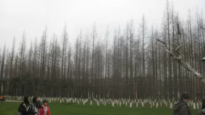
China Plants 'Great Green Wall' of Trees
Net deforestation continues, but at a slower rate as the world's largest ecological engineering project stretches for a planned 2,800 miles. It is hoped the new trees will halt the advance of the Gobi Desert.
How to Prevent National Forests Becoming 'National Ashtrays'
An editorial calls for innovative policy in post-fire recovery and reforestation. The recent release of the Environmental Impact Statement for the recovery of the Rim Fire should serve as a barometer for a "new public forestry."
From Academia to Action: An Indigenous Reforestation Effort in Los Angeles
Ary Amaya, a UCLA graduate student, leads an Indigenous-led reforestation effort in Los Angeles, integrating cultural practices and ecological restoration across 27 acres to promote Indigenous sovereignty and sustainable land management.

Rethinking Redlining
For decades we have blamed 100-year-old maps for the patterns of spatial racial inequity that persist in American cities today. An esteemed researcher says: we’ve got it all wrong.

Planetizen Federal Action Tracker
A weekly monitor of how Trump’s orders and actions are impacting planners and planning in America.

California High-Speed Rail's Plan to Right Itself
The railroad's new CEO thinks he can get the project back on track. The stars will need to align this summer.

US Senate Reverses California EV Mandate
The state planned to phase out the sale of gas-powered cars by 2035, a goal some carmakers deemed impossible to meet.

Trump Cuts Decimate Mapping Agency
The National Geodetic Survey maintains and updates critical spatial reference systems used extensively in both the public and private sectors.

Washington Passes First US ‘Shared Streets’ Law
Cities will be allowed to lower speed limits to 10 miles per hour and prioritize pedestrians on certain streets.
Urban Design for Planners 1: Software Tools
This six-course series explores essential urban design concepts using open source software and equips planners with the tools they need to participate fully in the urban design process.
Planning for Universal Design
Learn the tools for implementing Universal Design in planning regulations.
City of Camden Redevelopment Agency
City of Astoria
Transportation Research & Education Center (TREC) at Portland State University
Regional Transportation Commission of Southern Nevada
Toledo-Lucas County Plan Commissions