


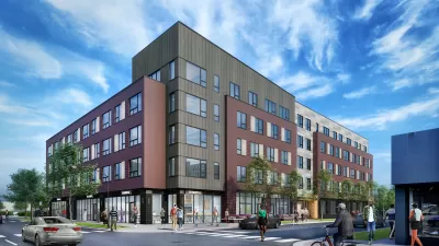
The October opening of a new 1.9-mile stretch of road on Chicago’s Southside anticipates a 40-year master plan for the Lakeside development—600 acres of new development in the middle of one of the country’s largest cities.
The former site of a U.S. Steel manufacturing plant will spend the next 40 years transforming into the Lakeside mixed-use development, reports Steven Vance.
The first sign of the new 600-acre development is the extension of South Lake Shore Drive, in the works for over a decade—even before developer McCaffery Interests and architecture and planning firm Skidmore, Owings & Merrill revealed the Lakeside master plan in 2004.
“The $64 million, state and city-funded road now connects to 79th Street at Rainbow Beach Park in the north and crosses the Calumet River with Ewing Avenue in the south. It does more than provide a bypass of residential areas to the west.”
The extension is critical to the success of the first development component of the Lakeside master plan: “South Lake Shore Drive, which connects to Lake Shore Drive via South Shore Drive and Marquette, gives Lakeside the edge it needs to attract retailers to anchor its first phase, called the Market Common.”
FULL STORY: Drive On, Southside

Commentary: A Vision for Responsible Neighborhood Revitalization
The first project under Chicago’s Woodlawn Housing Preservation Ordinance is taking shape, aiming to bring new housing and retail to the neighborhood while avoiding displacement.

700-Acre Master-Planned Community Planned in Utah
A massive development plan is taking shape for lakefront property in Vineyard, Utah—on the site of a former U.S. Steel Geneva Works facility.
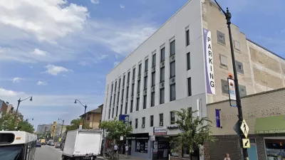
Chicago Garage Becomes 72-Unit Apartment Building
The East Lakeview project is within easy walking distance of local businesses and transit.

Maui's Vacation Rental Debate Turns Ugly
Verbal attacks, misinformation campaigns and fistfights plague a high-stakes debate to convert thousands of vacation rentals into long-term housing.

Planetizen Federal Action Tracker
A weekly monitor of how Trump’s orders and actions are impacting planners and planning in America.

In Urban Planning, AI Prompting Could be the New Design Thinking
Creativity has long been key to great urban design. What if we see AI as our new creative partner?

King County Supportive Housing Program Offers Hope for Unhoused Residents
The county is taking a ‘Housing First’ approach that prioritizes getting people into housing, then offering wraparound supportive services.

Researchers Use AI to Get Clearer Picture of US Housing
Analysts are using artificial intelligence to supercharge their research by allowing them to comb through data faster. Though these AI tools can be error prone, they save time and housing researchers are optimistic about the future.

Making Shared Micromobility More Inclusive
Cities and shared mobility system operators can do more to include people with disabilities in planning and operations, per a new report.
Urban Design for Planners 1: Software Tools
This six-course series explores essential urban design concepts using open source software and equips planners with the tools they need to participate fully in the urban design process.
Planning for Universal Design
Learn the tools for implementing Universal Design in planning regulations.
planning NEXT
Appalachian Highlands Housing Partners
Mpact (founded as Rail~Volution)
City of Camden Redevelopment Agency
City of Astoria
City of Portland
City of Laramie