


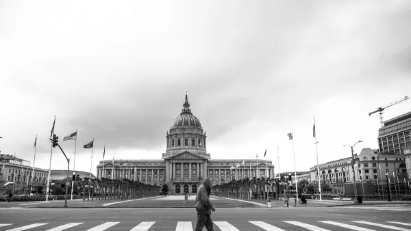
After an unsuccessful attempt in 2007, the City is at it again, but doing so in stages. Already in use in limited areas like City Hall and public housing projects, Monday's Market Street roll-out creates a nexus between wifi and surface transit.
On Monday, the city officially began "San_Francisco_Free_WiFi" on the city's main transit corridor, Market Street, writes John Coté. It follows Muni's streetcar from Castro Street to the foot of Market Street at San Francisco Bay. [See map in The Castro Biscuit].


Coté writes that "(u)nlike the original citywide proposal [by former Mayor Gavin Newsom in 2007], which collapsed amid political bickering between the mayor and the Board of Supervisors and concerns over a city contract with EarthLink and Google, this network is constructed and owned by the city."
The foundation of the Market Street wi-fi coverage is provided by "fiber-optic cable along Market Street and connections to network equipment set up on traffic lights and other city-owned fixtures."
Unlike the prior attempt where it contracted with private companies, the city set up its own network at a cost of about $500,000 after donations from two Silicon Valley companies.
"It was simpler, faster, better to do it on our own," said Marc Touitou, whom (Mayor Ed) Lee appointed as the city's chief information officer in April. "The quality is higher, with the technical design by the Department of Technology. We wanted high capacity. ... We wanted it to be cool - no strings attached, no ads."
Coté notes that "despite its proximity to Silicon Valley and the city's tech boom, [San Francisco] is not at the top of the network chain domestically. Residents of both Kansas Cities and Provo, Utah, can get on Google's 1-gigabit fiber network, with Austin, Texas, on the way."
Correspondent's note: This post was prepared, with great patience due to a weak connection to "San_Francisco_Free_WiFi", from a bagel shop about 25 feet from Market Street.
FULL STORY: S.F. rolls out 3 miles of free Wi-Fi along Market Street


Tomorrow's Digital City Center: The Glasgow Agenda
Take a walk around your downtown and what do you see. Most people are attached to their mobile phones, using them for directions, searching, and texting. See how can cities leverage digital technology to create a more engaging city center.
San Francisco Mayor Backtracks on Homelessness Goal
Mayor Dan Lurie ran on a promise to build 1,500 additional shelter beds in the city, complete with supportive services. Now, his office says they are “shifting strategy” to focus on prevention and mental health treatment.

Opinion: What San Francisco’s Proposed ‘Family Zoning’ Could Really Mean
Mayor Lurie is using ‘family zoning’ to encourage denser development and upzoning — but could the concept actually foster community and more human-scale public spaces?

Planetizen Federal Action Tracker
A weekly monitor of how Trump’s orders and actions are impacting planners and planning in America.

Chicago’s Ghost Rails
Just beneath the surface of the modern city lie the remnants of its expansive early 20th-century streetcar system.

Amtrak Cutting Jobs, Funding to High-Speed Rail
The agency plans to cut 10 percent of its workforce and has confirmed it will not fund new high-speed rail projects.

Ohio Forces Data Centers to Prepay for Power
Utilities are calling on states to hold data center operators responsible for new energy demands to prevent leaving consumers on the hook for their bills.

MARTA CEO Steps Down Amid Citizenship Concerns
MARTA’s board announced Thursday that its chief, who is from Canada, is resigning due to questions about his immigration status.

Silicon Valley ‘Bike Superhighway’ Awarded $14M State Grant
A Caltrans grant brings the 10-mile Central Bikeway project connecting Santa Clara and East San Jose closer to fruition.
Urban Design for Planners 1: Software Tools
This six-course series explores essential urban design concepts using open source software and equips planners with the tools they need to participate fully in the urban design process.
Planning for Universal Design
Learn the tools for implementing Universal Design in planning regulations.
Caltrans
City of Fort Worth
Mpact (founded as Rail~Volution)
City of Camden Redevelopment Agency
City of Astoria
City of Portland
City of Laramie