


In the Toronto area, the region's suburbs have evolved in ways that make them fundamentally different from their outdated postwar image. Yet the ways we think and talk about the suburbs haven't kept up with this new reality.
"The suburbs have the region’s majority share of population and job growth and are home to major infrastructures such as the airport and universities," say Sean Hertel and Roger Keil. "On these bases suburbia can no longer be considered subordinate to the City of Toronto. But still it is. Prejudices have power over facts – clouding our view of what the suburbs truly have become and why, most importantly, that should matter."
Hertel and Keil, who have been engaged in a three-year effort to develop "new approaches for planning, building, servicing and governing Toronto’s ever-growing and diversifying periphery", have just issued a new report that describes their recommendations for shaping the region's suburbs for their "urban future".
"The suburbs have become, like the city centres before them, the new arenas for forming and contesting politics, modes of governance, ways of life, and the forms and notions of community," they conclude. "Taken one step further, the suburb has become the new city. And a new kind of city – a 'regional city.'”
FULL STORY: Look for Toronto’s urban future in the booming suburbs

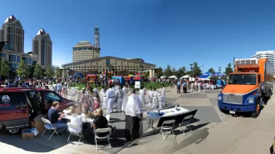
Reconsidering Toronto's Suburbs
Toronto's suburbs have often been dismissed as bland and banal. A closer look, however, reveals a diverse, complex landscape whose rapid changes have profound implications for the metropolis as a whole.
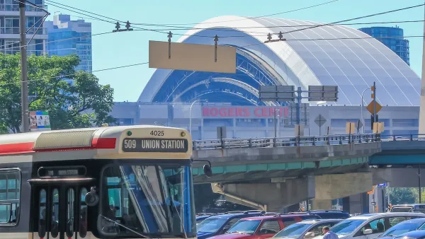
Suburbs Left Out of Toronto Transit Plan
Critics in Toronto are blasting a new transit plan from Mayor Rob Ford that they say overlooks the city's suburban areas.
Toronto Weighs Cheaper Transit, Parking Hikes for Major Events
Special event rates would take effect during large festivals, sports games and concerts to ‘discourage driving, manage congestion and free up space for transit.”

Maui's Vacation Rental Debate Turns Ugly
Verbal attacks, misinformation campaigns and fistfights plague a high-stakes debate to convert thousands of vacation rentals into long-term housing.

Planetizen Federal Action Tracker
A weekly monitor of how Trump’s orders and actions are impacting planners and planning in America.

Chicago’s Ghost Rails
Just beneath the surface of the modern city lie the remnants of its expansive early 20th-century streetcar system.

Bend, Oregon Zoning Reforms Prioritize Small-Scale Housing
The city altered its zoning code to allow multi-family housing and eliminated parking mandates citywide.

Amtrak Cutting Jobs, Funding to High-Speed Rail
The agency plans to cut 10 percent of its workforce and has confirmed it will not fund new high-speed rail projects.

LA Denies Basic Services to Unhoused Residents
The city has repeatedly failed to respond to requests for trash pickup at encampment sites, and eliminated a program that provided mobile showers and toilets.
Urban Design for Planners 1: Software Tools
This six-course series explores essential urban design concepts using open source software and equips planners with the tools they need to participate fully in the urban design process.
Planning for Universal Design
Learn the tools for implementing Universal Design in planning regulations.
planning NEXT
Appalachian Highlands Housing Partners
Mpact (founded as Rail~Volution)
City of Camden Redevelopment Agency
City of Astoria
City of Portland
City of Laramie