


Washington D.C. holds the dubious distinction as the nation's most congested city. As D.C. seeks ways to reduce its traffic, Arlington County, in suburban Virginia, has made great strides in convincing commuters to ditch their cars.
"While the District of Columbia grapples with proposed changes to its parking and zoning policies, last updated in 1958, nearby Arlington County, Virginia seems to have triumphed in its effort to minimize traffic congestion," reports Martin Di Caro. "Commuters are shifting from cars to transit and bikes."
"What’s more," he explains, "traffic volume has decreased on several major arterial roads in the county over the last two decades despite significant job and population growth, according to data compiled by researchers at Mobility Lab, a project of Arlington County Commuter Services."
"Researchers and transportation officials credit three initiatives for making the county less car-dependent: offering multiple alternatives to the automobile in the form of rail, bus, bicycling, and walking; following smart land use policies that encourage densely built, mixed-use development; and relentlessly marketing those transportation alternatives through programs that include five ‘commuter stores’ throughout the county where transit tickets, bus maps, and other information are available."
FULL STORY: How a D.C. Suburb Avoided the Capital’s Traffic Nightmare

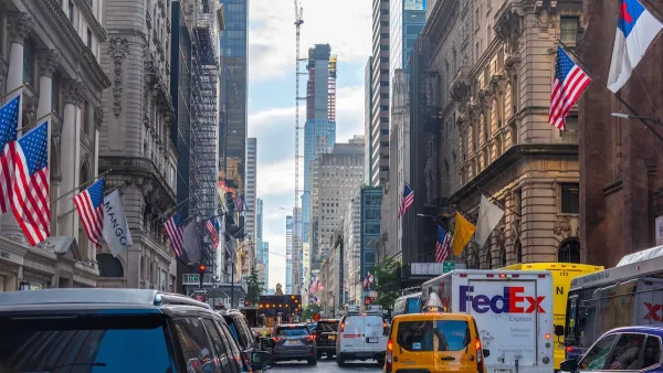
NYC Congestion Pricing: Still Working
10 million fewer vehicles entered the congestion pricing zone in the first six months of the program than last year, while pedestrian fatalities are at ‘historic lows.’

Judge Extends NYC Congestion Pricing Through at Least June 9
A federal judge halted the Trump administration’s effort to kill the program, which remains in limbo as a lawsuit filed by the MTA moves forward.

NYC Congestion Pricing Continues to Show Positive Results
While the Trump administration attempts to revoke the program’s federal approval, congestion pricing continues to reduce traffic, speed up bus travel times, and improve air quality in Manhattan.

Maui's Vacation Rental Debate Turns Ugly
Verbal attacks, misinformation campaigns and fistfights plague a high-stakes debate to convert thousands of vacation rentals into long-term housing.

Planetizen Federal Action Tracker
A weekly monitor of how Trump’s orders and actions are impacting planners and planning in America.

Chicago’s Ghost Rails
Just beneath the surface of the modern city lie the remnants of its expansive early 20th-century streetcar system.

Bend, Oregon Zoning Reforms Prioritize Small-Scale Housing
The city altered its zoning code to allow multi-family housing and eliminated parking mandates citywide.

Amtrak Cutting Jobs, Funding to High-Speed Rail
The agency plans to cut 10 percent of its workforce and has confirmed it will not fund new high-speed rail projects.

LA Denies Basic Services to Unhoused Residents
The city has repeatedly failed to respond to requests for trash pickup at encampment sites, and eliminated a program that provided mobile showers and toilets.
Urban Design for Planners 1: Software Tools
This six-course series explores essential urban design concepts using open source software and equips planners with the tools they need to participate fully in the urban design process.
Planning for Universal Design
Learn the tools for implementing Universal Design in planning regulations.
planning NEXT
Appalachian Highlands Housing Partners
Mpact (founded as Rail~Volution)
City of Camden Redevelopment Agency
City of Astoria
City of Portland
City of Laramie