


With more than 10,000 downloads in the U.S., i-Tree calculates the environmental and economic benefits of planting trees.
Based on an analysis by i-Tree, a software program developed by the U.S. Forest Service in partnership with Davey Tree company, street tree coverage in Pittsburgh, Pa. confers $2.4 million in environmental and aesthetic value per year to the city.
I-Tree calculates the carbon sequestration potential of each tree planted and the economic benefits of air pollution reduction. Its next version will also be able to analyze how urban forests affect air temperature, ultraviolet ray penetration and bird habitat.
Using i-Tree, the environmental nonprofit Tree Pittsburgh figured out that the city received $3 in benefits for every dollar it invested in urban forestation. In response, the city developed a new master plan to replenish its canopy, which is at half the recommended coverage now.
I-Tree is designed to be usable by anyone and exists in mobile as well as desktop version.
FULL STORY: That tree in the corner may be worth more than your house

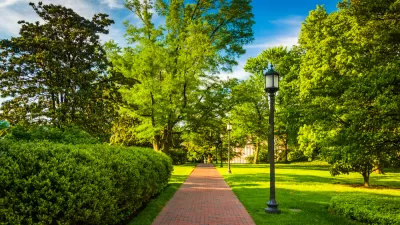
What's a Tree Worth?
The U.S. Forest Service has continued to refine the valuable i-Tree software program, which allows cities to calculate the benefits, in dollar figures, of the urban forest.
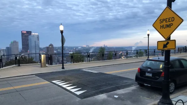
Pittsburgh Excels at Low-Cost, Quick-Build Traffic Calming
The city’s traffic calming initiative has led to a 6 percent average reduction in speeds on corridors with recent interventions.
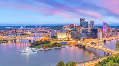
Downtown Pittsburgh Set to Gain 1,300 New Housing Units
Pittsburgh’s office buildings, many of which date back to the early 20th century, are prime candidates for conversion to housing.

Planetizen Federal Action Tracker
A weekly monitor of how Trump’s orders and actions are impacting planners and planning in America.

Restaurant Patios Were a Pandemic Win — Why Were They so Hard to Keep?
Social distancing requirements and changes in travel patterns prompted cities to pilot new uses for street and sidewalk space. Then it got complicated.

Map: Where Senate Republicans Want to Sell Your Public Lands
For public land advocates, the Senate Republicans’ proposal to sell millions of acres of public land in the West is “the biggest fight of their careers.”

Maui's Vacation Rental Debate Turns Ugly
Verbal attacks, misinformation campaigns and fistfights plague a high-stakes debate to convert thousands of vacation rentals into long-term housing.

San Francisco Suspends Traffic Calming Amidst Record Deaths
Citing “a challenging fiscal landscape,” the city will cease the program on the heels of 42 traffic deaths, including 24 pedestrians.

California Homeless Arrests, Citations Spike After Ruling
An investigation reveals that anti-homeless actions increased up to 500% after Grants Pass v. Johnson — even in cities claiming no policy change.
Urban Design for Planners 1: Software Tools
This six-course series explores essential urban design concepts using open source software and equips planners with the tools they need to participate fully in the urban design process.
Planning for Universal Design
Learn the tools for implementing Universal Design in planning regulations.
Heyer Gruel & Associates PA
JM Goldson LLC
Custer County Colorado
City of Camden Redevelopment Agency
City of Astoria
Transportation Research & Education Center (TREC) at Portland State University
Camden Redevelopment Agency
City of Claremont
Municipality of Princeton (NJ)