


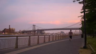
In the Bronx, three acres of newly planted wetlands were destroyed by Hurricane Sandy. As New York seeks to fortify its coast, should it rebuild this 'Paradise in the Bronx'?
The vision of developer Steven Smith, who built the three acres of wetlands in exchange for the right to develop the remainder of the 28-acre site in the Bronx, the "verdant slopes and grassy marshes" that resulted from two years of planning, nine months of work, and $1.5 million, were "washed away in a matter of hours by Hurricane Sandy’s 13-foot storm surge."
"What remain are a few patches of marsh grass, a Charlie Brown-like evergreen and one lonely, weedy mound just below a concrete wall," writes Liz Robbins.
Smith would like to rebuild the habitat, but as the city explores wetland restoration as one of several methods to fortify its coast, just how to do that is an open question. “This has to be done properly,” he said, shaking his head. “This is an environmental disaster. And you don’t want to repeat this mistake again.”
"Based on what survived [boulders piled as riprap and a mile-long 15-foot-high cast-concrete wall], Mr. Smith advocates rebuilding by integrating, or layering, hard and soft materials," says Robbins.
"Kelly Risotto, whose Land Use Ecological Services designed the habitat...said her company, based in Medford on Long Island, would replant in the spring." However, "[a] spokeswoman for the Environmental Conservation Department said it was still evaluating plans for the wetlands."
FULL STORY: In the Bronx, Restoring a Fleeting Paradise

East River Floodgates Rising in NYC
A tour of new infrastructure designed to protect the city’s East Side from catastrophic flooding.

Changes to Local Service in the Bronx Benefit Bus Speeds, Ridership
Another example of how improving bus service design can benefit transit riders and transit systems emerges in New York City. More such local system redesigns are on the way soon in the Big Apple.
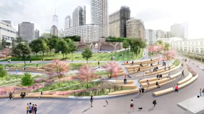
In Battery Park City, Public Infrastructure Meets Climate Resilience
A massive project underway in Lower Manhattan seeks to protect the shoreline from future flooding and mitigate the effects of climate change and rising sea levels.

Maui's Vacation Rental Debate Turns Ugly
Verbal attacks, misinformation campaigns and fistfights plague a high-stakes debate to convert thousands of vacation rentals into long-term housing.

Planetizen Federal Action Tracker
A weekly monitor of how Trump’s orders and actions are impacting planners and planning in America.

San Francisco Suspends Traffic Calming Amidst Record Deaths
Citing “a challenging fiscal landscape,” the city will cease the program on the heels of 42 traffic deaths, including 24 pedestrians.

Defunct Pittsburgh Power Plant to Become Residential Tower
A decommissioned steam heat plant will be redeveloped into almost 100 affordable housing units.

Trump Prompts Restructuring of Transportation Research Board in “Unprecedented Overreach”
The TRB has eliminated more than half of its committees including those focused on climate, equity, and cities.

Amtrak Rolls Out New Orleans to Alabama “Mardi Gras” Train
The new service will operate morning and evening departures between Mobile and New Orleans.
Urban Design for Planners 1: Software Tools
This six-course series explores essential urban design concepts using open source software and equips planners with the tools they need to participate fully in the urban design process.
Planning for Universal Design
Learn the tools for implementing Universal Design in planning regulations.
Heyer Gruel & Associates PA
JM Goldson LLC
Custer County Colorado
City of Camden Redevelopment Agency
City of Astoria
Transportation Research & Education Center (TREC) at Portland State University
Jefferson Parish Government
Camden Redevelopment Agency
City of Claremont