


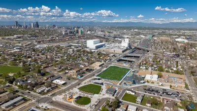
Something will be done to help Denver's Elyria and Swansea neighborhoods recover from decades of decline brought by the construction of I-70. Will a plan to bury the interstate be replaced with an ambitious proposal to reroute the road entirely?
Monte Whaley discusses the competing visions for how to "make way for the rebirth of a depressed part of [Denver]" that was severed by the construction of Interstate 70. The Colorado Department of Transportation (CDOT) favors a $1 billion plan to bury the highway and cap it with an 800-foot-long deck that could provide park space.
For some activists though, CDOT's plan "is not bold enough to save the Elyria and Swansea neighborhoods."
"CDOT
is really good at laying concrete," said Thaddeus Tecza, a senior
instructor emeritus of political science at the University of Colorado.
"These guys are engineers, and their answer to everything is to put down
a lane of concrete. What they are not really good at is planning for a
community."
"Tecza and Frank Sullivan - a retired biology
instructor at Front Range Community College - in August presented their
idea for realigning I-70 around Denver using the corridor occupied by
Interstates 270 and 76."
At an estimated cost of $4-$5 billion, CDOT nixed the Tecza and Sullivan plan last week. However, according to Whaley, "Tecza is undeterred, as are others who see the
East I-70 corridor as a unique opportunity to revamp north Denver and
maybe beyond."
FULL STORY: Planners suggest rerouting I-70 out of central Denver

Denver to Focus on Reviving Long-Neglected Area of the City
A $1.8 billion proposal to bury I-70 beneath a landscaped lid is just part of an ambitious plan to remake a 23-mile corridor of northeast Denver that includes the Elyria-Swansea and Globeville neighborhoods.
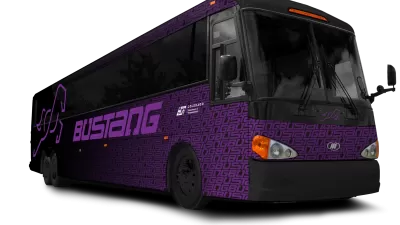
Commuting to Denver from Colorado Springs Gets Easier
Thanks to Bustang, an interregional bus service that began July 13, commuters can relax in reclining, high-back chairs or choose to plug their devices into outlets and utilize wifi for the 69-mile trip between Colorado's two largest cities.
Opening of Denver’s New Freeway Cap Park Triggers Gentrification Fears
Local residents fear rising housing costs and displacement with the opening of a new four-acre park built on a deck bridge over the newly reconstructed and widened I-70 interstate.

Maui's Vacation Rental Debate Turns Ugly
Verbal attacks, misinformation campaigns and fistfights plague a high-stakes debate to convert thousands of vacation rentals into long-term housing.

Planetizen Federal Action Tracker
A weekly monitor of how Trump’s orders and actions are impacting planners and planning in America.

In Urban Planning, AI Prompting Could be the New Design Thinking
Creativity has long been key to great urban design. What if we see AI as our new creative partner?

King County Supportive Housing Program Offers Hope for Unhoused Residents
The county is taking a ‘Housing First’ approach that prioritizes getting people into housing, then offering wraparound supportive services.

Researchers Use AI to Get Clearer Picture of US Housing
Analysts are using artificial intelligence to supercharge their research by allowing them to comb through data faster. Though these AI tools can be error prone, they save time and housing researchers are optimistic about the future.

Making Shared Micromobility More Inclusive
Cities and shared mobility system operators can do more to include people with disabilities in planning and operations, per a new report.
Urban Design for Planners 1: Software Tools
This six-course series explores essential urban design concepts using open source software and equips planners with the tools they need to participate fully in the urban design process.
Planning for Universal Design
Learn the tools for implementing Universal Design in planning regulations.
planning NEXT
Appalachian Highlands Housing Partners
Mpact (founded as Rail~Volution)
City of Camden Redevelopment Agency
City of Astoria
City of Portland
City of Laramie