


The internet has been ablaze this week over whether Apple's newly announced operating system will eliminate walking and public transit directions by replacing Google Maps with its own mapping system.
Despite supposed reports to the contrary, Philip Bump, a registered Apple developer, claims in an article in Grist that Apple's new operating system, unveiled this week, "didn't kill walking and public transit directions," and he's got the screenshots to prove it.
It turns out, however, that he's only partially correct. According to Angie Schmitt, at Streetsblog, who's a bit more accurate in her wording, "The new, Apple-developed map application will include driving
directions and walking directions, but no transit information, at least
not standard. Instead, if you want to figure out how to get somewhere
without driving, users will have to download a third-party application."
As Schmitt notes, "In response, WalkScore today launched a campaign
to have the transit feature restored, asking supporters to tweet Apple
directly. 'We believe that having built-in transit directions on your
phone helps public transit work better for everyone,' the company says
on its petition site."
Some, however, are quite happy with the ditching of Google's Map app.
"Apple has finally ditched the sclerotic Google maps app that comes on
every iPhone, in favor of its own mapping system which will be able to
give you turn-by-turn directions. It was about time--Google's
application hasn't improved one jot from a usability standpoint, ever
since it was introduced," writes Mark Wilson for Co.Design.
"What's particularly exciting is that Apple's maps will crowd-source
the traffic data it detects from all the people using the app--and then
use that information to calculate less-trafficked routes."
FULL STORY: Why the rumors about the iPhone ditching walking, public transit are wrong

The Quest to Build the Best Map
Why are Google, Apple, Nokia, and Microsoft funneling significant resources into creating the best digital maps? "[A]ll share the same hunch that maps sit at the core of our digital future," writes Farhad Manjoo.

Google Maps Introduces New Transit, EV Features
It will now be easier to find electric car charging stations and transit options.
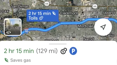
Google Maps Feature Identifies Most Fuel-Efficient Routes
A new feature highlights routes that use the least gas to help users make the most fuel-efficient driving decisions.

Planetizen Federal Action Tracker
A weekly monitor of how Trump’s orders and actions are impacting planners and planning in America.

Chicago’s Ghost Rails
Just beneath the surface of the modern city lie the remnants of its expansive early 20th-century streetcar system.

San Antonio and Austin are Fusing Into one Massive Megaregion
The region spanning the two central Texas cities is growing fast, posing challenges for local infrastructure and water supplies.

Since Zion's Shuttles Went Electric “The Smog is Gone”
Visitors to Zion National Park can enjoy the canyon via the nation’s first fully electric park shuttle system.

Trump Distributing DOT Safety Funds at 1/10 Rate of Biden
Funds for Safe Streets and other transportation safety and equity programs are being held up by administrative reviews and conflicts with the Trump administration’s priorities.

German Cities Subsidize Taxis for Women Amid Wave of Violence
Free or low-cost taxi rides can help women navigate cities more safely, but critics say the programs don't address the root causes of violence against women.
Urban Design for Planners 1: Software Tools
This six-course series explores essential urban design concepts using open source software and equips planners with the tools they need to participate fully in the urban design process.
Planning for Universal Design
Learn the tools for implementing Universal Design in planning regulations.
planning NEXT
Appalachian Highlands Housing Partners
Mpact (founded as Rail~Volution)
City of Camden Redevelopment Agency
City of Astoria
City of Portland
City of Laramie