


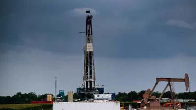
Joe Romm reports on a new U.S. Geological Survey (USGS) paper that ties the unprecedented rise in earthquakes of magnitude 3.0 and greater across a broad swath of the country to man-made sources.
The USGS report, to be delivered next week at the annual meeting of the Seismological Society of America, is the latest in a growing body of documentation tying the unusual increase in earthquakes in locales across the country to the processes associated with oil and gas drilling by hydraulic fracturing (fracking).
According to Romm, "Some quakes may be caused by the original fracking - that is, by injecting a fluid mixture into the earth to release natural gas (or oil). More appear to be caused by reinjecting the resulting brine deep underground."
While the USGS paper stops short of conclusively tying the seismic activity to a specific fracking process, the journal EnergyWire, which has previewed the paper's findings, points out, "all of the potential causes they explore in the paper relate to drilling, or more specifically, deep underground injection of drilling waste."
FULL STORY: Shale Shocked: ‘Remarkable Increase’ In U.S. Earthquakes ‘Almost Certainly Manmade,’ USGS Scientists Report

Texas Earthquakes Linked to Fracking
A new study reveals earthquakes that began at shallower depths than previously thought are associated with wastewater disposal sites from fracking operations.
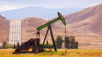
New Oil and Gas Drilling in California May Be Subject to Moratorium
Gov. Gavin Newsom pleased environmentalists by doing what his predecessor, Gov. Jerry Brown, refused – halting all new oil and gas fracking and placing a moratorium on another extraction method linked to a massive oil spill in Kern County.

Department of Interior Plans to Open 1 Million Acres in California to Fracking
The Bakersfield Office of the Bureau of Land Management released an environmental study that is the basis for undoing a 2013 de facto moratorium on fracking on federal lands in California. The Supplemental EIS triggers a 45-day public comment period.

Maui's Vacation Rental Debate Turns Ugly
Verbal attacks, misinformation campaigns and fistfights plague a high-stakes debate to convert thousands of vacation rentals into long-term housing.

Planetizen Federal Action Tracker
A weekly monitor of how Trump’s orders and actions are impacting planners and planning in America.

In Urban Planning, AI Prompting Could be the New Design Thinking
Creativity has long been key to great urban design. What if we see AI as our new creative partner?

King County Supportive Housing Program Offers Hope for Unhoused Residents
The county is taking a ‘Housing First’ approach that prioritizes getting people into housing, then offering wraparound supportive services.

Researchers Use AI to Get Clearer Picture of US Housing
Analysts are using artificial intelligence to supercharge their research by allowing them to comb through data faster. Though these AI tools can be error prone, they save time and housing researchers are optimistic about the future.

Making Shared Micromobility More Inclusive
Cities and shared mobility system operators can do more to include people with disabilities in planning and operations, per a new report.
Urban Design for Planners 1: Software Tools
This six-course series explores essential urban design concepts using open source software and equips planners with the tools they need to participate fully in the urban design process.
Planning for Universal Design
Learn the tools for implementing Universal Design in planning regulations.
planning NEXT
Appalachian Highlands Housing Partners
Mpact (founded as Rail~Volution)
City of Camden Redevelopment Agency
City of Astoria
City of Portland
City of Laramie