


Low-income residents of the Upper 9th Ward in New Orleans have lived alongside a potentially lethal legacy of federal policy decisions -- and on top of a 95-acre municipal dump.
"The weeds were growing high in the Upper 9th Ward long before Landrieu took office-and indeed, even before the hurricane hit. For more than a decade before that disaster, a quieter one was unfolding, one that caused residents of the nearly 100 percent black, largely low-income community to live alongside a potentially lethal legacy of federal policy decisions. In the case of Horne's neighborhood, the decisions were spectacular failures. Her house, as well as the abandoned HANO development she sees from her front porch and the public elementary school where she worked and her grandchildren studied, were built atop a 95-acre municipal dump," writes author Ariella Cohen.
..."Welcome to the new normal-where entire swaths of city neighborhoods deteriorate behind fences and no one is too surprised when a child invents a story to explain why so many buildings in her community are vacant. The circumstances that brought New Orleans' neighborhoods into their current limbo are a combination of singular events and larger national trends. Many communities around the country currently confront similar fates. For evidence, look to the urban prairies of Detroit; Youngstown, Ohio; and Flint, Mich."
Thanks to Nekoro Gomes
FULL STORY: New Orleans: Federal Housing, Environmental Policies Clash

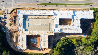
How Atlanta Built 7,000 Housing Units in 3 Years
The city’s comprehensive, neighborhood-focused housing strategy focuses on identifying properties and land that can be repurposed for housing and encouraging development in underserved neighborhoods.
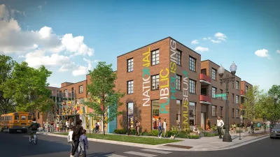
Museum of Public Housing Opens in Chicago
The museum highlights the history of public housing in the United States using displays intimately woven with family artifacts.
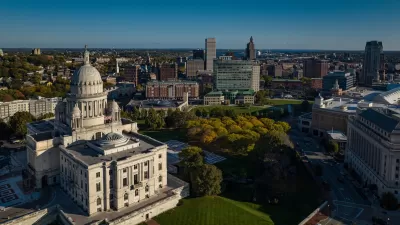
How Will Rhode Island Spend a $120M Housing Bond?
Voters approved a bond measure that includes up to $10 million for creating a public housing entity.

Planetizen Federal Action Tracker
A weekly monitor of how Trump’s orders and actions are impacting planners and planning in America.

Chicago’s Ghost Rails
Just beneath the surface of the modern city lie the remnants of its expansive early 20th-century streetcar system.

San Antonio and Austin are Fusing Into one Massive Megaregion
The region spanning the two central Texas cities is growing fast, posing challenges for local infrastructure and water supplies.

Since Zion's Shuttles Went Electric “The Smog is Gone”
Visitors to Zion National Park can enjoy the canyon via the nation’s first fully electric park shuttle system.

Trump Distributing DOT Safety Funds at 1/10 Rate of Biden
Funds for Safe Streets and other transportation safety and equity programs are being held up by administrative reviews and conflicts with the Trump administration’s priorities.

German Cities Subsidize Taxis for Women Amid Wave of Violence
Free or low-cost taxi rides can help women navigate cities more safely, but critics say the programs don't address the root causes of violence against women.
Urban Design for Planners 1: Software Tools
This six-course series explores essential urban design concepts using open source software and equips planners with the tools they need to participate fully in the urban design process.
Planning for Universal Design
Learn the tools for implementing Universal Design in planning regulations.
planning NEXT
Appalachian Highlands Housing Partners
Mpact (founded as Rail~Volution)
City of Camden Redevelopment Agency
City of Astoria
City of Portland
City of Laramie