


A new website uses Google Maps and your photographs to overlay images of the past on current locations.
Images are geolocated on Google Maps as locations are pinpointed. You can browse by location or zip code and see what images have been uploaded so far. Images are matched up as closely as possible in StreetView to show the actual location as it appeared.
There's also an iPhone app as well -- the HistoryPin website explains what it does:
"Explore the streets - holding your phone up to the street, the app uses your camera view to display nearby images. By selecting the image, it can be overlaid onto the modern view to create an historical comparison, which you can toggle or fade between."
FULL STORY: Picture the Past: Historypin Mashes Up Archived Photos with the Present


Google Maps Introduces New Transit, EV Features
It will now be easier to find electric car charging stations and transit options.
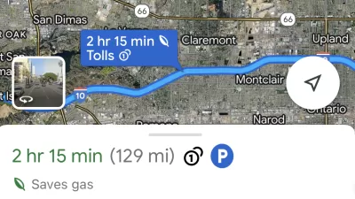
Google Maps Feature Identifies Most Fuel-Efficient Routes
A new feature highlights routes that use the least gas to help users make the most fuel-efficient driving decisions.

Google Maps Now Lets You Feed Your Parking Meter
Google's newest partnership offers contactless parking meter payments and transit fare purchases.

Maui's Vacation Rental Debate Turns Ugly
Verbal attacks, misinformation campaigns and fistfights plague a high-stakes debate to convert thousands of vacation rentals into long-term housing.

Planetizen Federal Action Tracker
A weekly monitor of how Trump’s orders and actions are impacting planners and planning in America.

San Francisco Suspends Traffic Calming Amidst Record Deaths
Citing “a challenging fiscal landscape,” the city will cease the program on the heels of 42 traffic deaths, including 24 pedestrians.

Defunct Pittsburgh Power Plant to Become Residential Tower
A decommissioned steam heat plant will be redeveloped into almost 100 affordable housing units.

Trump Prompts Restructuring of Transportation Research Board in “Unprecedented Overreach”
The TRB has eliminated more than half of its committees including those focused on climate, equity, and cities.

Amtrak Rolls Out New Orleans to Alabama “Mardi Gras” Train
The new service will operate morning and evening departures between Mobile and New Orleans.
Urban Design for Planners 1: Software Tools
This six-course series explores essential urban design concepts using open source software and equips planners with the tools they need to participate fully in the urban design process.
Planning for Universal Design
Learn the tools for implementing Universal Design in planning regulations.
Heyer Gruel & Associates PA
JM Goldson LLC
Custer County Colorado
City of Camden Redevelopment Agency
City of Astoria
Transportation Research & Education Center (TREC) at Portland State University
Jefferson Parish Government
Camden Redevelopment Agency
City of Claremont