


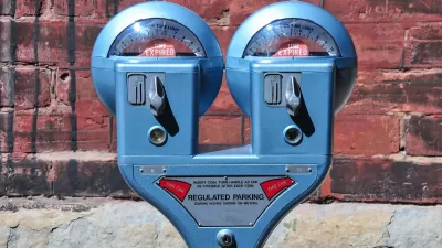
Google's newest partnership offers contactless parking meter payments and transit fare purchases.

.jpg)
The newest tech upgrade to your driving experience: paying for metered parking right from the Google Maps app. As Kirsten Korosec writes for TechCrunch, after a trial run in Austin, the "feature will expand first via Android to more than 400 U.S. cities, including Boston, Cincinnati, Houston, Los Angeles, New York and Washington, D.C." With the demand for contactless payment options growing as a result of COVID-19 precautions, Google's partnership with transportation software companies Passport and ParkMobile offers a compelling option for drivers wanting to avoid contact with public facilities.
"When navigating with Google Maps on iOS and Android, drivers in certain cities in the U.S. will see an option to pay for parking with Google Pay as they approach their destination. This means a user has to set up a Google Pay account, which is linked to a credit or debit card," according to Korosec. The app will also let customers add time to their meter without going back to their car.
Google is also working with more than 80 global transit agencies to integrate fare purchases, route planning, and digital fare cards into its Maps app.
FULL STORY: Google Maps users can now pay for parking or their transit fare right from the app

Want Less Traffic and More Parking? Start Charging for It!
Cities often fail to effectively manage parking—and the public pays for it.

America's Most Popular National Park Could Start Charging for Parking
The Great Smoky Mountains National Park, the nation's most visited and one of only a handful with no admission fee, could institute a parking fee to pay for much-needed maintenance.
Do Bike Lanes Actually Cause Business Loss?
The often unsubstantiated assumption that loss of street parking due to bike lane installations leads to lost business can have a chilling effect on bike infrastructure.

Maui's Vacation Rental Debate Turns Ugly
Verbal attacks, misinformation campaigns and fistfights plague a high-stakes debate to convert thousands of vacation rentals into long-term housing.

Planetizen Federal Action Tracker
A weekly monitor of how Trump’s orders and actions are impacting planners and planning in America.

In Urban Planning, AI Prompting Could be the New Design Thinking
Creativity has long been key to great urban design. What if we see AI as our new creative partner?

King County Supportive Housing Program Offers Hope for Unhoused Residents
The county is taking a ‘Housing First’ approach that prioritizes getting people into housing, then offering wraparound supportive services.

Researchers Use AI to Get Clearer Picture of US Housing
Analysts are using artificial intelligence to supercharge their research by allowing them to comb through data faster. Though these AI tools can be error prone, they save time and housing researchers are optimistic about the future.

Making Shared Micromobility More Inclusive
Cities and shared mobility system operators can do more to include people with disabilities in planning and operations, per a new report.
Urban Design for Planners 1: Software Tools
This six-course series explores essential urban design concepts using open source software and equips planners with the tools they need to participate fully in the urban design process.
Planning for Universal Design
Learn the tools for implementing Universal Design in planning regulations.
planning NEXT
Appalachian Highlands Housing Partners
Mpact (founded as Rail~Volution)
City of Camden Redevelopment Agency
City of Astoria
City of Portland
City of Laramie