


Jarrett Walker argues that reports of the decline of public transportation ridership have been exaggerated.
Jarrett writes that one of the main reasons the numbers are confused is that they lump together areas of low transit use and high transit use into "metropolitan areas".
"Metro areas, by definition, conflate a dense core city and a lot of low-density suburbs, and thus conceal the dramatic difference between transit's relevance in those places. Metro area statistics may be useful for judging the relative economic performance of different parts of a country, but they always conceal most of what matters in understanding how transit really works. If you want to understand how and why transit works and fails, you should spend less time comparing metro Los Angeles and metro New York and more time comparing Manhattan with Nassau County, or comparing the LA/Hollywood core with the western San Fernando Valley."
FULL STORY: ridership down in america? look deeper

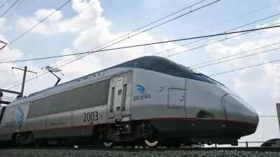
Amtrak Will Likely Break Ridership Record This Year
Despite closures and delays on major lines, passenger rail travel is set to break pre-pandemic records.

Virginia Passenger Rail Sets Ridership Records, Seeks More Wins
Virginia’s commitment to intercity rail is paying off in record ridership numbers, but more work will be necessary to achieve the state’s ambitions for passenger rail.

California Could Cut Transit Spending Even as Systems Struggle
Governor Newsom’s proposed budget would cut over $2 billion from transit infrastructure funds.

Planetizen Federal Action Tracker
A weekly monitor of how Trump’s orders and actions are impacting planners and planning in America.

Maui's Vacation Rental Debate Turns Ugly
Verbal attacks, misinformation campaigns and fistfights plague a high-stakes debate to convert thousands of vacation rentals into long-term housing.

Cuomo Is the Candidate of Both NIMBYs and Developers. What Gives?
In the New York City mayoral race, odd bedfellows align to preserve the housing status quo.

San Antonio and Austin are Fusing Into one Massive Megaregion
The region spanning the two central Texas cities is growing fast, posing challenges for local infrastructure and water supplies.

Charlottesville Temporarily Has No Zoning Code
A judge ordered the Virginia city to throw out its newly revised zoning code, leaving permitting for new development in legal limbo.

In California Battle of Housing vs. Environment, Housing Just Won
A new state law significantly limits the power of CEQA, an environmental review law that served as a powerful tool for blocking new development.
Urban Design for Planners 1: Software Tools
This six-course series explores essential urban design concepts using open source software and equips planners with the tools they need to participate fully in the urban design process.
Planning for Universal Design
Learn the tools for implementing Universal Design in planning regulations.
Heyer Gruel & Associates PA
JM Goldson LLC
Custer County Colorado
City of Camden Redevelopment Agency
City of Astoria
Transportation Research & Education Center (TREC) at Portland State University
Jefferson Parish Government
Camden Redevelopment Agency
City of Claremont