


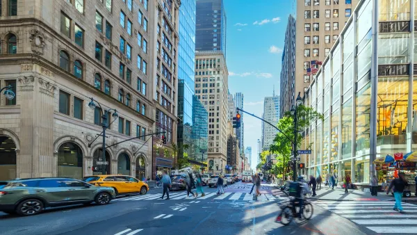
There's a lot of babbling on in this blog about how streets are public space, that they are for people, and that they should be designed equitably for everyone.

The driving public, after decades of being shown images on television and in print that owning a car makes you better/cooler/[add other socially positive superlatives here] than everyone else, can express outrage at the thought that planners might think of taking away "their streets". Quite irrational I think, because if you plunk down tens of thousands of dollars for such a fancy machine, you'd think there would be a modicum of satisfaction knowing that roadway congestion equates to more quality time spent with man's most prized material possession, no? Nonetheless, the pursuit of a rational urban roadway network is worth the struggle, and we must march forward.
The question I put forth here is, essentially, how much is too much? In pure city-grid fashion Hoboken, we have been regularly encountering development opportunities where closures of street segments have been on the table. The reasons for these closures vary from underpass clearance issues to the creation of small public spaces/parks/plazas, etc. The arguments for and against roadway closures are both valid:
For: Eliminates through-traffic in neighborhoods streets/properly redirects through-traffic to arterials; provides opportunities for new public spaces in a dense environment with little available free land; adds more interesting locations throughout the city; increases opportunities for social interactions; more fairly uses limited public space for a broader range of residents.
Against: Disrupts the flexibility (takes away options) and distribution of traffic in the grid; unfairly redistributes traffic volumes onto other neighboring streets; adds to motorist confusion; fear of adding to congestion on other streets (although this is largely disproved time and again in examples worldwide); takes away on-street parking.
Not all of these are true or valid for every situation, but they are the common arguments. In an entirely philosophical complete streets debate, one might argue that eliminating vehicular use on any street makes that street incomplete. A counter argument to this could be that, looking at the city as a whole, just as some streets are, where appropriate, designed exclusively for cars (tunnels, highway ramps, etc.), other streets are justified, where appropriate, to be designed exclusive of cars.
Professionally, the industry makes the case both ways, and I'm not sure there is consensus on where and when one way or the other applies. There are clearly camps on both ends of the spectrum that lean heavily towards a steadfast policy, but the rest of us fall somewhere in the middle and the answer, as is often the case, is not so immediately evident. What say ye?

Opinion: LOS has ‘No Redeeming Quality’
The commonly used Level of Service metric that grades intersections based on traffic speed rather than safety is a key contributor to dangerous roadways.
The Vast Potential of the Right-of-Way
One writer argues that the space between two building faces is the most important element of the built environment.
Milwaukee Launches Vision Zero Plan
Seven years after the city signed its Complete Streets Policy, the city is doubling down on its efforts to eliminate traffic deaths.

Maui's Vacation Rental Debate Turns Ugly
Verbal attacks, misinformation campaigns and fistfights plague a high-stakes debate to convert thousands of vacation rentals into long-term housing.

Planetizen Federal Action Tracker
A weekly monitor of how Trump’s orders and actions are impacting planners and planning in America.

In Urban Planning, AI Prompting Could be the New Design Thinking
Creativity has long been key to great urban design. What if we see AI as our new creative partner?

King County Supportive Housing Program Offers Hope for Unhoused Residents
The county is taking a ‘Housing First’ approach that prioritizes getting people into housing, then offering wraparound supportive services.

Researchers Use AI to Get Clearer Picture of US Housing
Analysts are using artificial intelligence to supercharge their research by allowing them to comb through data faster. Though these AI tools can be error prone, they save time and housing researchers are optimistic about the future.

Making Shared Micromobility More Inclusive
Cities and shared mobility system operators can do more to include people with disabilities in planning and operations, per a new report.
Urban Design for Planners 1: Software Tools
This six-course series explores essential urban design concepts using open source software and equips planners with the tools they need to participate fully in the urban design process.
Planning for Universal Design
Learn the tools for implementing Universal Design in planning regulations.
planning NEXT
Appalachian Highlands Housing Partners
Mpact (founded as Rail~Volution)
City of Camden Redevelopment Agency
City of Astoria
City of Portland
City of Laramie