


Undercounting is likely one of the biggest challenges facing the U.S. Census Bureau as it prepares to run its decennial census in April. Certain parts of the country will prove problematic when it comes time to count.
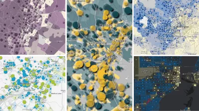
Jill Wilson of the Brookings Institution's Metropolitan Policy Program looked at a USA Today map to calculate the percent of each metropolitan area's population that lives in a "hard-to-count" neighborhood.
"Among the top 20 hard-to-count metros, only three (Albany, GA, Yakima, WA, and New York, NY) are not in a state bordering Mexico. The top sixteen are in TX, CA, NM, or AZ, though not all are border metros, with a cluster in California's "inland empire." Three metros (McAllen, Laredo, and Brownsville, TX) have more than half of their population in hard-to-count neighborhoods, and another seven have at least one third. Among metros with at least 1 million people, Los Angeles, New York, Las Vegas, Miami, and Houston rank highest, with at least one in five residents living in a hard-to-count neighborhood.
These places have their work cut out for them."
FULL STORY: Census NOT as easy as 1-2-3…


Interactive Map Reveals America's “Shade Deserts”
Launched by UCLA and American Forests to combat heat-related deaths, the tool maps the shade infrastructure for over 360 U.S. cities.
Explore US Demographics With the New ACS Atlas Collection
Esri's new ACS Atlas Collection offers interactive applications that visualize the latest U.S. demographic and socio-economic data, enabling users to explore over 175 curated web maps across various thematic areas.

Maps: How Much of Your City is Parking?
The percentage of land dedicated to parking in the central districts of major U.S. cities ranges from 4 percent to as much as 42 percent.

Maui's Vacation Rental Debate Turns Ugly
Verbal attacks, misinformation campaigns and fistfights plague a high-stakes debate to convert thousands of vacation rentals into long-term housing.

Planetizen Federal Action Tracker
A weekly monitor of how Trump’s orders and actions are impacting planners and planning in America.

In Urban Planning, AI Prompting Could be the New Design Thinking
Creativity has long been key to great urban design. What if we see AI as our new creative partner?

King County Supportive Housing Program Offers Hope for Unhoused Residents
The county is taking a ‘Housing First’ approach that prioritizes getting people into housing, then offering wraparound supportive services.

Researchers Use AI to Get Clearer Picture of US Housing
Analysts are using artificial intelligence to supercharge their research by allowing them to comb through data faster. Though these AI tools can be error prone, they save time and housing researchers are optimistic about the future.

Making Shared Micromobility More Inclusive
Cities and shared mobility system operators can do more to include people with disabilities in planning and operations, per a new report.
Urban Design for Planners 1: Software Tools
This six-course series explores essential urban design concepts using open source software and equips planners with the tools they need to participate fully in the urban design process.
Planning for Universal Design
Learn the tools for implementing Universal Design in planning regulations.
planning NEXT
Appalachian Highlands Housing Partners
Mpact (founded as Rail~Volution)
City of Camden Redevelopment Agency
City of Astoria
City of Portland
City of Laramie