


By mapping rat infestations, New York City's health inspectors have found a whole new way to beat back the rodents.
"Michael Mills, a veteran health inspector in New York City, helps create a map of the city you won't find in any guidebook: a rat map.
The city's rat map was first introduced a year ago, with an intensive pilot program in the Bronx. Mills and other inspectors scoured the streets, building by building, cataloging rat hotspots - places that show so-called active rat signs, such as lived-in burrows, fresh droppings, tell-tale gnaw marks on plastic garbage bags - in an effort to target rodent-control measures more effectively. That geocoding information was entered into each inspector's hand-held indexing computer and aggregated with similar data from all across the borough.
Today, rodent complaints by residents from all over New York are electronically pinpointed on the city's computerized rat map, which allows inspectors to track complaints and hotspots over time and determine how well rat-control efforts are working. The results, after just one year, should be music to the ears of most New Yorkers: When the pilot study began in the Bronx, inspectors found active rat signs on 3,100 of the borough's 39,000 properties. Preliminary results now show that 1,250 of those properties are rat-free. That's a 40% dropoff in infestations."
FULL STORY: Mapping the Rats in New York City


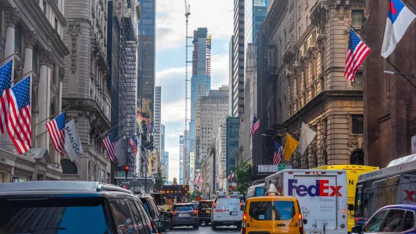
MTA Poised to Break Ridership, On-Time Service Records
New York City’s transit system saw strong increases in ridership and improvements in service quality in the first half of 2025.
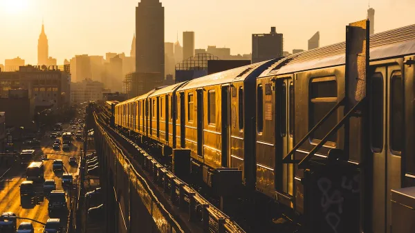
Aging NYC Subway Cars No Match for Extreme Heat
The MTA receives thousands of complaints about broken air conditioning on subway cars each summer.
NYC Congestion Pricing: Still Working
10 million fewer vehicles entered the congestion pricing zone in the first six months of the program than last year, while pedestrian fatalities are at ‘historic lows.’

Planetizen Federal Action Tracker
A weekly monitor of how Trump’s orders and actions are impacting planners and planning in America.

Chicago’s Ghost Rails
Just beneath the surface of the modern city lie the remnants of its expansive early 20th-century streetcar system.

San Antonio and Austin are Fusing Into one Massive Megaregion
The region spanning the two central Texas cities is growing fast, posing challenges for local infrastructure and water supplies.

Since Zion's Shuttles Went Electric “The Smog is Gone”
Visitors to Zion National Park can enjoy the canyon via the nation’s first fully electric park shuttle system.

Trump Distributing DOT Safety Funds at 1/10 Rate of Biden
Funds for Safe Streets and other transportation safety and equity programs are being held up by administrative reviews and conflicts with the Trump administration’s priorities.

German Cities Subsidize Taxis for Women Amid Wave of Violence
Free or low-cost taxi rides can help women navigate cities more safely, but critics say the programs don't address the root causes of violence against women.
Urban Design for Planners 1: Software Tools
This six-course series explores essential urban design concepts using open source software and equips planners with the tools they need to participate fully in the urban design process.
Planning for Universal Design
Learn the tools for implementing Universal Design in planning regulations.
planning NEXT
Appalachian Highlands Housing Partners
Mpact (founded as Rail~Volution)
City of Camden Redevelopment Agency
City of Astoria
City of Portland
City of Laramie