


That's how developers at Google describe the release of Google Earth for the iPhone. Boing Boing's Joel Johnson wonders why it wasn't released for Android first.
"With just a swipe of your finger you can fly from Peoria to Paris to Papua New Guinea, or anywhere in between. It may be small, but it brings all the power of Google Earth to the palm of your hand, including all of the same global imagery and 3D terrain. You can even browse any of our 8 million Panoramio photos or read Wikipedia articles.
With Google Earth for iPhone, you can:
• Tilt your iPhone to adjust your view to see mountainous terrain
• View the Panoramio layer and browse the millions of geo-located photos from around the world
• View geo-located Wikipedia articles
• Use the 'Location' feature to fly to your current location
• Search for cities, places and business around the globe with Google Local Search"
From Boing Boing:
"I mean, I get it: Google is a big company. There are lots of product teams. Those teams probably have a lot of autonomy. Google is fine making software for all platforms, not just its own, since their customers use a variety of platforms.
But we're not talking about Gmail here. We're talking about a stunning bit of entertainment software that would set Android phones apart from their competition. And then Google Mobile distributes it for iPhone first?"
Thanks to gadgets.boingboing.net
FULL STORY: Introducing Google Earth for iPhone

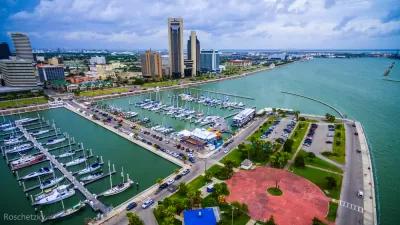
Visualizing Worst-Case Scenario Sea Level Rise on the Texas Coast
Much of the state political leadership in Texas has been slow to accept the existence of climate change, much less the role of the state's economy, land use, and infrastructure planning in exacerbating the crisis. Maybe this will help wake them up?
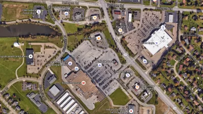
Retail Parking: A View from Google Earth
Google Earth can be a useful tool for understanding how parking is being used in your community and to identify where over- or under-utilization occurs.
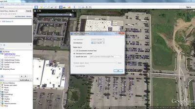
Using Google Earth to Understand Parking Utilization
As planners we use maps on a daily basis. This article shares how to find the date and time that a Google Earth image was taken, which can be helpful in undertaking site analysis and understanding parking utilization.

Planetizen Federal Action Tracker
A weekly monitor of how Trump’s orders and actions are impacting planners and planning in America.

Chicago’s Ghost Rails
Just beneath the surface of the modern city lie the remnants of its expansive early 20th-century streetcar system.

San Antonio and Austin are Fusing Into one Massive Megaregion
The region spanning the two central Texas cities is growing fast, posing challenges for local infrastructure and water supplies.

Since Zion's Shuttles Went Electric “The Smog is Gone”
Visitors to Zion National Park can enjoy the canyon via the nation’s first fully electric park shuttle system.

Trump Distributing DOT Safety Funds at 1/10 Rate of Biden
Funds for Safe Streets and other transportation safety and equity programs are being held up by administrative reviews and conflicts with the Trump administration’s priorities.

German Cities Subsidize Taxis for Women Amid Wave of Violence
Free or low-cost taxi rides can help women navigate cities more safely, but critics say the programs don't address the root causes of violence against women.
Urban Design for Planners 1: Software Tools
This six-course series explores essential urban design concepts using open source software and equips planners with the tools they need to participate fully in the urban design process.
Planning for Universal Design
Learn the tools for implementing Universal Design in planning regulations.
planning NEXT
Appalachian Highlands Housing Partners
Mpact (founded as Rail~Volution)
City of Camden Redevelopment Agency
City of Astoria
City of Portland
City of Laramie