


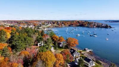
Though the state is considered a model for smart planning, Oregon's sprawling landscape shows that the state has much the same problems as the rest of the country.
"His uncle was a big-time civil engineer, traveling the world, leaving his fingerprints on projects across several continents.
But Leonard Rydell's engineering career kept him closer to his Oregon roots. And after 36 years laying out the road and service grids for projects throughout suburban Portland -- including much of Wilsonville's Charbonneau development -- he says he's come to realize the region's glowing reputation in urban planning is increasingly an illusion.
He smiled when 1000 Friends of Oregon and two other conservation groups recently called on state planners to change suburban sprawl patterns that, despite light rail and urban growth boundaries, have left 71 percent of Oregonians driving to work alone.
The "up, not out" idea of high-density mixed-use development is a great theory, Rydell said. But the development reality on the ground is that we're heading toward a destination that, in the end, will look and function almost exactly like most places across the country.
To make his point, Rydell jumps up from the chair in his office on the second floor of his Newberg home and rattles down the steps, out the front door, directly into the middle of the street in front of his home.
"What do you see?"
The shoulder-to-shoulder jumble of ranch homes, the cars jammed into the little driveways and lining much of the absurdly wide street is a scene from any city in America.
"Tell me," he continues, as a Chevy Suburban whizzes by us at a good 10 mph above the speed limit, "does it make you feel good?"
"Exactly," he says, guessing my answer, "and yet, this is still what pretty much every city's code is encouraging us to design and build."
Cookie-cutter subdivisions. Shopping clusters. Industrial and business clusters."
FULL STORY: Sprawl belies Oregon's rep for planning

Maine Law Promotes Smart Growth
New state legislation encourages cities to plan around ‘smart growth’ principles to preserve farmland and open space, and use infill development to build more housing.
A Better Understanding of Smart Growth Benefits
Smart Growth creates compact, multimodal communities where residents consume less land, drive less, and rely more on non-auto modes. Planners have important stories to tell about the benefits of Smart Growth.

Getting to Work: New Commute Duration Heatmaps
The Mineta Transportation Institute's new interactive website produces heatmaps that illustrate commute duration—the number of minutes that workers spend traveling to their jobs—plus related information, for most U.S. communities.

Maui's Vacation Rental Debate Turns Ugly
Verbal attacks, misinformation campaigns and fistfights plague a high-stakes debate to convert thousands of vacation rentals into long-term housing.

Planetizen Federal Action Tracker
A weekly monitor of how Trump’s orders and actions are impacting planners and planning in America.

In Urban Planning, AI Prompting Could be the New Design Thinking
Creativity has long been key to great urban design. What if we see AI as our new creative partner?

Cal Fire Chatbot Fails to Answer Basic Questions
An AI chatbot designed to provide information about wildfires can’t answer questions about evacuation orders, among other problems.

What Happens if Trump Kills Section 8?
The Trump admin aims to slash federal rental aid by nearly half and shift distribution to states. Experts warn this could spike homelessness and destabilize communities nationwide.

Sean Duffy Targets Rainbow Crosswalks in Road Safety Efforts
Despite evidence that colorful crosswalks actually improve intersection safety — and the lack of almost any crosswalks at all on the nation’s most dangerous arterial roads — U.S. Transportation Secretary Duffy is calling on states to remove them.
Urban Design for Planners 1: Software Tools
This six-course series explores essential urban design concepts using open source software and equips planners with the tools they need to participate fully in the urban design process.
Planning for Universal Design
Learn the tools for implementing Universal Design in planning regulations.
Appalachian Highlands Housing Partners
Gallatin County Department of Planning & Community Development
Heyer Gruel & Associates PA
Mpact (founded as Rail~Volution)
City of Camden Redevelopment Agency
City of Astoria
City of Portland
City of Laramie