As cell phones, GPS systems, dashboard computers, and roadside sensors create more accurate traffic reports, the ubiqituous AM radio helicopter traffic report could be a thing of the past.


"...Decades after radio stations put spotters in helicopters, new methods of gathering and disseminating traffic data are emerging, methods that combine roadside sensors, automobile navigation systems, and wireless connections to provide real-time customized traffic information.
"'Charlie in the Chopper is a marketing guy,' said Doug Finlay, chief executive of SpeedInfo. 'He says traffic's heavy on 128.' And you say, 'Boy, am I glad I'm not there.' He's not providing information, but entertainment."
"But WBZ-AM (1030) general manager Ted Jordan said he's not concerned that the new technologies might threaten BZ's 'Traffic on the 3's' franchise, the traffic reports that air every 10 minutes through much of the day."
"As long as I can remember, people have been predicting the end of AM radio," Jordan said. "Television was going to kill it, then FM radio. But AM just kept morphing."
Read the full story: Traffic reports without choppers
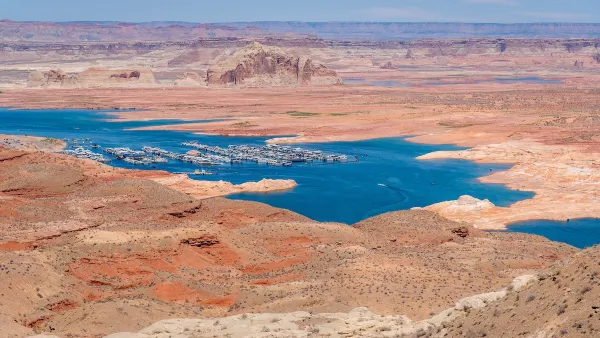
Desperate measures: Advocates weigh draining Lake Powell to fill Colorado River
Draining the reservoir could reduce evaporation losses by a couple hundred thousand acre-feet.

Eastern Nebraska is running out of electricity
Data centers and electrification are straining eastern Nebraska’s grid, throttling economic development.

Malls are becoming the midtowns of the future
Mall and office park redevelopments are a generational opportunity to create new nodes of urbanity.

Officials claim feds 'rushed' Amtrak environmental review
Amtrak plans to move their Chicago maintenance facility from an industrial area to a residential one.

NYC breaks ground on anti-flooding infrastructure project
New York City's new system will reduce stormwater flows to local sewers by 90%.

One Kentucky town’s secret to affordable housing
The Smoketown Community Land Trust has already built seven affordable homes for community members.

FREE Course: Walkable City 1: Why Walkability?
After describing his path towards focusing on walkability as the essence of good planning, Jeff Speck marches through his five principal reasons for making more walkable places.
Reinventing Malls: Planning Alchemy—Turning Gray Fields Into Gold
The course focuses on the opportunities and imperatives that shape reinvention of mall sites.

City of Rosemead
Rutgers University, Edward J. Bloustein School of Planning and Public Policy
One Hundred Miles
University of Michigan School for Environment and Sustainability (SEAS)
Hunter College, City University of New York (CUNY)
The Architects Foundation
City of Cambridge
Montrose County
The Pocatello Development Authority