A new study combines multiple data sources to assess roadway risks.


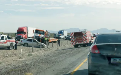
In a study funded by the Texas Department of Transportation, a University of Houston professor combined multiple data sources such as pavement conditions and roadway geometry to identify the city's most dangerous roadway segments.
As Nick Ross explains in an article for SMBtech, "At the core of the research is the use of large language model-based crash narrative analysis to identify and quantify pavement-related crash risk. The LLM component converts unstructured police crash narratives into structured, mechanism-specific labels – such as hydroplaning or curve-related loss of control."
The research differs from others in that it combines these vast datasets to add depth to crash research that is often missing key risk factors. "These details tend to be embedded in free-text narratives, making large-scale extraction difficult through manual review or simple keyword rules."
Read the full story: University Of Houston Engineer Using AI To Improve Road Safety

Video: Why are US roads so dangerous?
The CityNerd YouTube channel highlights key statistics from the 2026 Dangerous by Design report.

Has Progress on Travel Safety Run Off the Road?
Changing technology and rebuilding infrastructure to improve road safety are long-term strategies. How can enforcement and interventions that influence driver behavior make a difference in reducing traffic deaths sooner?

Greenways Plus Highways: A Deadly Combination
The design of intersections between major roadways and bike and pedestrian paths can have fatal consequences.

Planetizen Federal Action Tracker
A weekly monitor of how Trump’s orders and actions are impacting planners and planning in America.

California plans to bury El Niño’s downpour
If the state plays its cards right, it may be able to store a billion acre-feet of El Niño’s water in aquifers.

Chicago breaks ground on $3 billion megadevelopment
The new neighborhood, titled Foundry Park, will one day host 3,700 residences.

California High-Speed Rail Authority CEO resigns after $600,000 scandal
Under Ian Choudri, the authority used taxpayer dollars to fund first class flights and trips to nightclubs.

Want to study the Missouri River? Soon, you may need unanimous approval from 10 states
Legislation would require 10 governors’ permission to study or build projects moving water outside the basin.

Desperate measures: Advocates weigh draining Lake Powell to fill Colorado River
Draining the reservoir could reduce evaporation losses by a couple hundred thousand acre-feet.

FREE Course: Walkable City 1: Why Walkability?
After describing his path towards focusing on walkability as the essence of good planning, Jeff Speck marches through his five principal reasons for making more walkable places.
Reinventing Malls: Planning Alchemy—Turning Gray Fields Into Gold
The course focuses on the opportunities and imperatives that shape reinvention of mall sites.

City of Rosemead
Rutgers University, Edward J. Bloustein School of Planning and Public Policy
One Hundred Miles
Hunter College, City University of New York (CUNY)
The Architects Foundation
University of Cincinnati Online
City of Cambridge
Montrose County
The Pocatello Development Authority