


A new USGS study reveals that more than half of the nation’s documented orphan wells lie within aquifers supplying the vast majority of U.S. groundwater, posing widespread risks of contamination from aging, unplugged infrastructure.
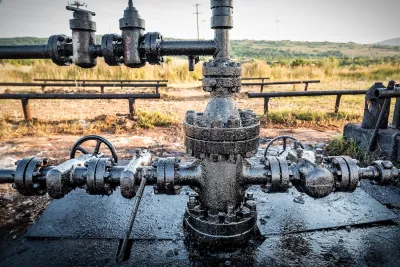
A new study by the U.S. Geological Survey offers the first national geospatial analysis of how orphaned oil and gas wells — unplugged and ownerless — may threaten major aquifers across the United States. Researchers examined over 117,000 documented orphan wells and found that more than half are located within aquifers that supply 94 percent of the country’s groundwater, raising serious concerns about contamination from aging, failure-prone infrastructure.
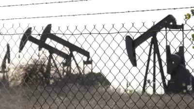
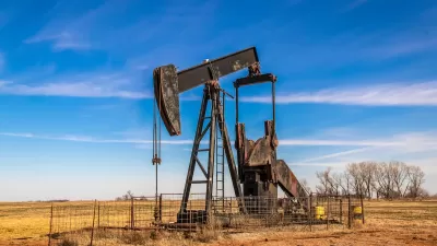
The study highlights specific regions at high risk, including Pennsylvania and the broader Appalachian basin, where many of the country’s oldest wells were drilled and where well casing failures are more likely. Gulf Coast aquifers, which include contamination-prone wetlands and open water areas, and densely drilled areas of California’s Central Valley and coastal zones also emerged as high-vulnerability zones. In central Oklahoma, the Ada-Vamoosa aquifer has the highest concentration of orphan wells per square mile.
Researchers recommend that policymakers and groundwater managers use this mapping as a tool to prioritize monitoring, remediation, and further local investigations. With tens of thousands of additional orphan wells added to federal datasets in recent years — and more being discovered — the threat to drinking water sources is growing. The findings underscore the need to accelerate well-plugging efforts and consider groundwater protection as a central concern in energy transition and land reuse strategies.
FULL STORY: Scientists Map Where Orphan Wells Threaten Aquifers in the U.S.


Using Old Oil and Gas Wells for Green Energy Storage
Penn State researchers have found that repurposing abandoned oil and gas wells for geothermal-assisted compressed-air energy storage can boost efficiency, reduce environmental risks, and support clean energy and job transitions.
Healing the Land: Collaborative Effort to Reclaim Orphan Well Sites
The Well Done Foundation and U.S. Fish and Wildlife Service are partnering to plug over 110 orphan wells across four National Wildlife Refuges, restoring habitats, protecting ecosystems, and reducing methane emissions.
How an Environmental Liability Tax Could Solve the Orphan Well Crisis
An Environmental Liability Tax (ELT) on oil extraction would fund orphaned well cleanup, shift financial responsibility to oil companies, and address the environmental and public health risks posed by abandoned wells.

Montreal Mall to Become 6,000 Housing Units
Place Versailles will be transformed into a mixed-use complex over the next 25 years.

Planetizen Federal Action Tracker
A weekly monitor of how Trump’s orders and actions are impacting planners and planning in America.

DARTSpace Platform Streamlines Dallas TOD Application Process
The Dallas transit agency hopes a shorter permitting timeline will boost transit-oriented development around rail stations.

Study: 4% of Truckers Lack a Valid Commercial License
Over 56% of inspected trucks had other violations.

Chicago Judge Orders Thousands of Accessible Ped Signals
Only 3% of the city's crossing signals are currently accessible to blind pedestrians.

Philadelphia Swaps Car Lanes for Bikeways in Unanimous Vote
The project will transform one of the handful of streets responsible for 80% of the city’s major crashes.
Urban Design for Planners 1: Software Tools
This six-course series explores essential urban design concepts using open source software and equips planners with the tools they need to participate fully in the urban design process.
Planning for Universal Design
Learn the tools for implementing Universal Design in planning regulations.
City of Mt Shasta
City of Camden Redevelopment Agency
City of Astoria
Transportation Research & Education Center (TREC) at Portland State University
US High Speed Rail Association
City of Camden Redevelopment Agency
Municipality of Princeton (NJ)