


Parklets got a boost during the Covid-19 pandemic, when the concept was translated to outdoor dining programs that offered restaurants a lifeline during the shutdown.
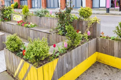
The International Parklet Symposium was held last week in San Francisco, and Streetsblog San Francisco’s Roger Rudick highlights the main takeaways.
“The conference speakers talked about how parklets were dreamed up as a way to return a portion of our streets to something more akin to their original use,” Rudick notes, providing a brief history of how street space in the United States was ceded to motor vehicles. Although streets were originally used as shared public spaces for vendors, pedestrians, and children at play, “with the help of auto industry lobbying, the concept of ‘jaywalking’ was created and it became essentially illegal to use the street for anything except driving.”
In 2005, Park(ing) Day launched in San Francisco, calling for a return to a different way of prioritizing public right-of-way and curbside space. “Now, of course, the idea of shared spaces and parklets has spread so far and wide even Tokyo (which doesn't really have street parking) has parklets, explained the speakers.” During the Covid-19 pandemic, the parklet concept was adapted to restaurants who could no longer serve patrons indoors, leading to a proliferation of outdoor dining patios in former parking spots.
FULL STORY: Conference: Parklets Key to Rolling Back Motordom’s Takeover of the Streets

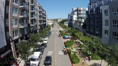
San Diego Swaps Parking Lane for Kid-Friendly Mini Park
The block-long greenway will feature interactive play equipment and landscaping.
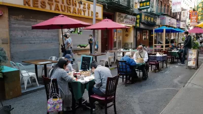
NYC Losing Many Outdoor Dining Areas Due to Expensive New Regulations
Restaurant owners say the city’s new outdoor dining program makes it too difficult and expensive to operate al fresco setups.

Opinion: Support Citizen-Led Public Space Projects
A public space advocate outlines how Philadelphia’s city leaders could support the parklets, plazas, and other public space conversions that proliferated during the pandemic.

Maui's Vacation Rental Debate Turns Ugly
Verbal attacks, misinformation campaigns and fistfights plague a high-stakes debate to convert thousands of vacation rentals into long-term housing.

Planetizen Federal Action Tracker
A weekly monitor of how Trump’s orders and actions are impacting planners and planning in America.

In Urban Planning, AI Prompting Could be the New Design Thinking
Creativity has long been key to great urban design. What if we see AI as our new creative partner?

Cal Fire Chatbot Fails to Answer Basic Questions
An AI chatbot designed to provide information about wildfires can’t answer questions about evacuation orders, among other problems.

What Happens if Trump Kills Section 8?
The Trump admin aims to slash federal rental aid by nearly half and shift distribution to states. Experts warn this could spike homelessness and destabilize communities nationwide.

Sean Duffy Targets Rainbow Crosswalks in Road Safety Efforts
Despite evidence that colorful crosswalks actually improve intersection safety — and the lack of almost any crosswalks at all on the nation’s most dangerous arterial roads — U.S. Transportation Secretary Duffy is calling on states to remove them.
Urban Design for Planners 1: Software Tools
This six-course series explores essential urban design concepts using open source software and equips planners with the tools they need to participate fully in the urban design process.
Planning for Universal Design
Learn the tools for implementing Universal Design in planning regulations.
Appalachian Highlands Housing Partners
Gallatin County Department of Planning & Community Development
Heyer Gruel & Associates PA
Mpact (founded as Rail~Volution)
City of Camden Redevelopment Agency
City of Astoria
City of Portland
City of Laramie