


A combination of infrastructure, connectivity, and quality equipment has made the Canadian city’s bike share system successful despite frigid winters and challenging geography.
With the average daily February temperature at 26 degrees Fahrenheit, how did Montreal become a city of cyclists? A piece by Ben Abramson in Strong Towns investigates.
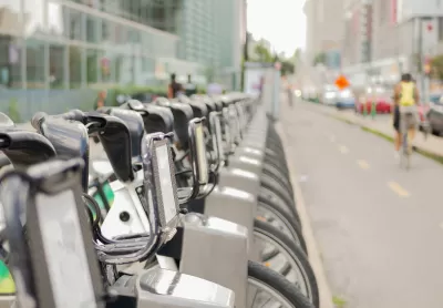
Montreal’s bikeshare program, called BIXI, has grown exponentially since launching in 2009. With over 10,000 bikes, it has the largest fleet in Canada and one of the largest in North America. BIXI has a user base of more than 500,000 riders, who took almost 12 million trips in 2023, more than double the 5.8 million in (pre-COVID) 2019.
The system added winter service this year. Abramson writes that the city set up the bike share system for success in a number of ways. “On the product side, it was important to launch with high-quality cycles, a well-designed network, and a pricing structure that riders are comfortable with.”
The system is also well integrated with local public transit and other transportation infrastructure. “But most important of all is making the network available where users live and travel between.” The system uses fixed stations scattered throughout the region, not just in central Montreal, providing a broad network that avoids the issues faced by dockless devices.
FULL STORY: How a Cold, Hilly Canadian City Became a Year-Round Cycling Success Story


Montreal Bike Share Breaks Ridership Record With 13 Million Rides
The Bixi system introduced a winter pilot project last year, leading to a rise in winter cycling.

Fort Worth To Relaunch Bike Share System in January
Trinity Metro shuttered its current system at the end of November and plans to relaunch with a mostly-electric system.

Biking Outpaces Transit Use in DC
D.C. residents and visitors take as many as 30 million trips on bikes or shared mobility, yet bike lanes cover just one quarter of one percent of the District’s streets.

Montreal Mall to Become 6,000 Housing Units
Place Versailles will be transformed into a mixed-use complex over the next 25 years.

Planetizen Federal Action Tracker
A weekly monitor of how Trump’s orders and actions are impacting planners and planning in America.

DARTSpace Platform Streamlines Dallas TOD Application Process
The Dallas transit agency hopes a shorter permitting timeline will boost transit-oriented development around rail stations.

Study: 4% of Truckers Lack a Valid Commercial License
Over 56% of inspected trucks had other violations.

Chicago Judge Orders Thousands of Accessible Ped Signals
Only 3% of the city's crossing signals are currently accessible to blind pedestrians.

Philadelphia Swaps Car Lanes for Bikeways in Unanimous Vote
The project will transform one of the handful of streets responsible for 80% of the city’s major crashes.
Urban Design for Planners 1: Software Tools
This six-course series explores essential urban design concepts using open source software and equips planners with the tools they need to participate fully in the urban design process.
Planning for Universal Design
Learn the tools for implementing Universal Design in planning regulations.
City of Mt Shasta
City of Camden Redevelopment Agency
City of Astoria
Transportation Research & Education Center (TREC) at Portland State University
US High Speed Rail Association
City of Camden Redevelopment Agency
Municipality of Princeton (NJ)