


Designing roads for low-speed vehicles like golf carts can make getting around safer and easier for seniors.
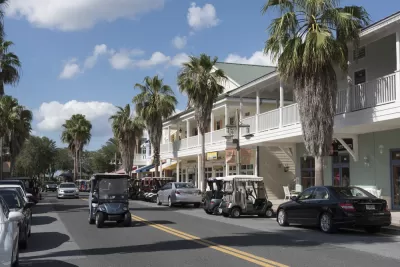
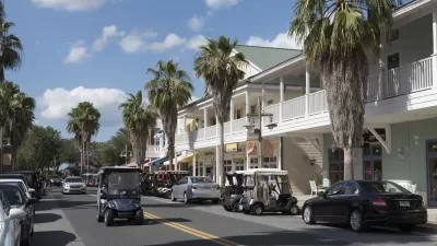
There is much for urbanists to critique about Florida's master-planned community the Villages–currently "the fastest-growing metropolitan statistical area in the country." But one thing the Imagineer-designed retirement community got right, argues Alissa Walker, is their enthusiastic support of golf carts as a transportation mode.
"Those golf carts, in fact, make a lot of urban-transportation planners salivate. By some estimates, one-third of all trips in the Villages are taken in them. They run on electricity, or on a little bit of non-ethanol gasoline (dispensed from old-timey pumps, even). They are lightweight and barely pollute. They’re not supposed to go faster than 20 mph, and they don’t kill many people the way cars do (although it does happen)."
Not that the Villages is any kind of car-free utopia. Ryan Erisman, author of Inside the Bubble: The Complete Guide to Florida’s Most Popular Community, says "[m]ost people still have cars" which they use for any trips outside the immediate neighborhood. Meanwhile, the Villages has no public transit to speak of. "Of course we should be working, in general, to put everything closer together so nobody has to get behind the wheel at the age of 95 — or 55, for that matter." But the concept of actively designing for golf carts or other slow-speed vehicles could go a long way toward making cities more friendly to seniors and the general population.
FULL STORY: There's One Thing We Can Learn From the Villages Success

The Villages and the Dangers of Holding Too Tightly to the Past
Some parts of The Villages, Florida, the nation's largest retirement community and one of its most popular master planned communities, bear a striking resemblance to the neotraditional development favored by famous early examples of New Urbanism.

Mainstreaming the Golf Cart
Seniors are on the cutting edge of a movement to make Neighborhood Electric Vehicles (NEVs), otherwise known as golf carts, a viable form of everyday transportation.
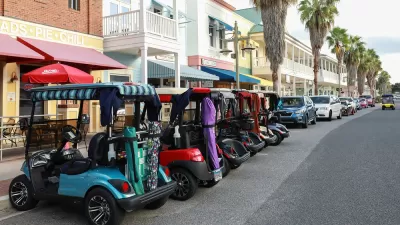
Why Golf Carts Could Quietly Revolutionize Transportation
More communities are catching on to the benefits of golf carts as a safe, low-emissions mode of transport for neighborhood trips.

Montreal Mall to Become 6,000 Housing Units
Place Versailles will be transformed into a mixed-use complex over the next 25 years.

Planetizen Federal Action Tracker
A weekly monitor of how Trump’s orders and actions are impacting planners and planning in America.

DARTSpace Platform Streamlines Dallas TOD Application Process
The Dallas transit agency hopes a shorter permitting timeline will boost transit-oriented development around rail stations.

Study: 4% of Truckers Lack a Valid Commercial License
Over 56% of inspected trucks had other violations.

Chicago Judge Orders Thousands of Accessible Ped Signals
Only 3% of the city's crossing signals are currently accessible to blind pedestrians.

Philadelphia Swaps Car Lanes for Bikeways in Unanimous Vote
The project will transform one of the handful of streets responsible for 80% of the city’s major crashes.
Urban Design for Planners 1: Software Tools
This six-course series explores essential urban design concepts using open source software and equips planners with the tools they need to participate fully in the urban design process.
Planning for Universal Design
Learn the tools for implementing Universal Design in planning regulations.
City of Mt Shasta
City of Camden Redevelopment Agency
City of Astoria
Transportation Research & Education Center (TREC) at Portland State University
US High Speed Rail Association
City of Camden Redevelopment Agency
Municipality of Princeton (NJ)