Communities have good reasons to protect trees and forests. Planners can help make this happen.



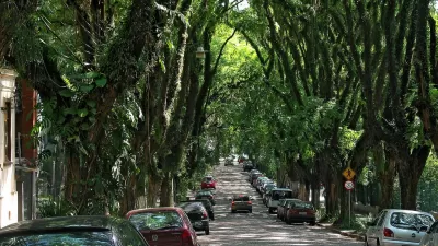
Last week was Tu Bishvat, the Jewish new year of the trees, when we celebrate trees and all of the great things they provide. Hug a tree, visit a forest, and enjoy fruits! Everybody is welcome: Judeo-Christians, pagans, Shintoists, rational humanistic environmentalists, and other beings, all have good reasons to celebrate, appreciate, and protect trees.
Communities have many good reasons to protect trees and forests, or to use the more general terms, green space and open space, which includes parks, farms and natural habitat. Urban green space makes people healthier and happier, reduces stormwater management costs, and reduces heat island effects. Preserving wildlife habitat is critical to a healthy global ecosystem. Impervious surface area (land covered by buildings, pavement and other hard surfaces) can be considered a key environmental indicator: as impervious surface increases environmental quality declines.

What does this mean for planning? Many public policies and planning decisions affect urban trees, open space, and pavement. The following practices can help minimize per capita impervious surface area and preserve environmentally healthy lands.
Local governments can plant trees, for example, along streets, which provide beauty, shade, habitat, and air quality, and as much as possible, favor native varieties that support local ecosystems. Governments can also encourage private property owners to plant trees and other natural habitat, and minimize monoculture lawns, which are the least productive type of green space. They can debunk anti-tree myths, such as claims that lower-income neighborhoods don't value tree-cover or that trees harm infrastructure such as sidewalks and utility lines.

Governments can also plan for adequate public parks. For health and happiness, urban households should be located within a ten minute walk of local parks and recreational facilities, and 20% or more of urban land should be devoted to public parks.
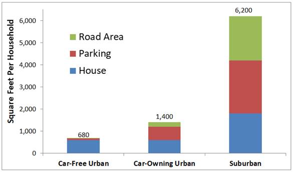
However, urban tree preservation should not be an impediment to compact infill development. As discussed in one of my previous blogs, "Seeing the Urban Forest for the Trees," infill projects often require displacing trees, which NIMBYs use to oppose those projects, resulting in far larger environmental damages from more lower-density, sprawled development. Considering house, road, and parking requirements, a typical household living car-free in an urban townhouse or apartment requires just a tenth as much impervious surface as the same family with two cars living in a single-family suburban house.
Roadway planning decisions often involve trade-offs between trees and traffic or parking capacity. Many communities are applying streescaping and road diet concepts to reduce the amount of road right-of-way that must be devoted to pavement to accommodate more green space. In the past, trees along roadways were often removed to safely accommodate higher speed traffic; a new ethos preserves trees and reduces traffic speeds for safety and livability sake.
Regional governments can encourage compact infill over urban expansion with Smart Growth and New Urbanist policies that increase allowable densities and building heights, establish urban growth boundaries, and by reducing subsidies that encourage sprawled development, such as urban fringe utility line and roadway expansions. This provides many economic, social and environmental benefits.
In urban areas, a major portion of impervious surface consists of roads and parking facilities. Surveys indicate that typical communities have two to six off-street parking spaces per vehicle, plus significant amounts of land devoted to highways. Reducing vehicle ownership and managing parking facilities more efficiently so fewer spaces are needed to serve motorists' demands, helps free up urban land for more affordable housing and green space.
Most fundamentally, planners can help their communities implement more multimodal transportation planning and establish vehicle-travel reduction targets to favor space-efficient modes (e.g., walking, bicycling, and public transit) over space-intensive automobile travel.

Life is better with trees! Smart planning can protect greenspace for a better quality of life, infrastructure savings, and environmental protection.
For More information
American Forests provides tools for tree and forest protection.
Subha Ranjan Banerjee and Ben Welle (2016), Bigger Isn’t Always Better: Narrow Traffic Lanes Make Cities Safer, World Resources Institute.
CNT (2016), Stalled Out: How Empty Parking Spaces Diminish Neighborhood Affordability, Center for Neighborhood Technology.
GreenTRIP Connect is a free tool allowing users to easily calculate how accessible, multi-modal location and traffic reduction strategies can reduce driving from residential development throughout California, and calculates how much money and space can be saved from right-sized parking.
Todd Litman (2016), Parking Management: Comprehensive Implementation Guide, Victoria Transport Policy Institute.
Reinventing Parking is a website the provides ideas for parking policy reforms.
Ottawa (2015), A 90 Second Lesson in How Parking Can Kill Cities, City of Ottawa.
Richard Willson (2015), Parking Management for Smart Growth, Island Press.

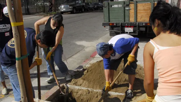
Los Angeles Takes Steps to Grow Out Its Urban Forest
Los Angeles is rolling out a street tree inventory to complement other sustainability measures included in its own Green New Deal. The focus is on underserved neighborhoods.
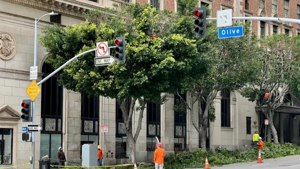
LA’s Tree Canopy is Nearing a ‘Point of Failure’
Calls to 311 for “tree emergencies” are rising, endangering a resource that helps bring down urban temperatures and reduce air pollution.
Mapping Georgia’s Urban Forests
Georgia Tech’s latest urban canopy assessment for Atlanta uses high-resolution mapping and a Potential Planting Index to guide data-driven tree preservation.

Planetizen Federal Action Tracker
A weekly monitor of how Trump’s orders and actions are impacting planners and planning in America.

The state-sanctioned urbicide of Austin
People don’t kill cities. Freeways do.

US to reduce Colorado River water deliveries to Mexico
A new Colorado Treaty amendment reduces Mexico’s Colorado River water allocation by 250,000 acre feet.

5 New England states march closer to 800 megawatt wind energy project
Securing federal approval for the project may be complicated under the Trump administration, which has historically been hostile towards domestic wind power.

Baltimore to break ground on $50 million Transit Priority Project
The project will bring faster bus trips, safer streets and better bike connections to Baltimore.

Airbnb launches $250 million 'last-dollar financing' housing accelerator, makes first investment in Austin
The company will put $6.4 million towards affordable housing development in Texas’ capital.

FREE Course: Walkable City 1: Why Walkability?
After describing his path towards focusing on walkability as the essence of good planning, Jeff Speck marches through his five principal reasons for making more walkable places.
Reinventing Malls: Planning Alchemy—Turning Gray Fields Into Gold
The course focuses on the opportunities and imperatives that shape reinvention of mall sites.

Eagle County Government
Harvard University Graduate School of Design
Nashville Planning Department
The Architects Foundation
University of Cincinnati Online
The Pocatello Development Authority
The Urban Renewal Agency of the City of Pocatello
Journal of the American Planning Association


