The Maryland Transportation Authority has been studying the potential of a new bridge across the Chesapeake Bay, connecting Annapolis to Queen Anne's County to the East.


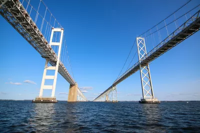
"Maryland transportation officials have determined that building a bridge adjacent to the Chesapeake Bay Bridge would relieve traffic backups better than an additional crossing much farther to the north or south," reports Katherine Shaver.
With the announcement, the state narrowed down the number of choices for a new Bay Bridge alignment from 14 to three, but the aforementioned route adjacent to the Chesapeake Bay Bridge has already been identified as the most likely to reduce congestion.
"The Bay Bridge connects U.S. routes 50 and 301 between Crofton in Anne Arundel County on the western shore with the same road in Queenstown in Queen Anne’s County on the east," explains Shaver. The possibility of a new expanse has worried residents on either side of the body of water that the bridge would bring new traffic to local roads.
Read the full story: A new bridge close to Chesapeake Bay Bridge would provide the most traffic relief, study says

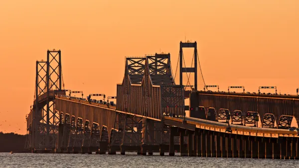
14 Potential Locations for a New Bridge Across the Chesapeake Bay
A long term plan to add an additional bridge connection across the Chesapeake Bay is underway in Maryland.
Maryland Spending $5 Million to Study Another Span for the Bay Bridge
Maryland Governor Larry Hogan has thrown support behind a study to add a third span to the Bay Bridge that spans the Chesapeake Bay.
Editorial: The Best New Chesapeake Bay Bridge Is No New Chesapeake Bay Bridge
The Baltimore Sun Editorial Board finds numerous faults with the state of Maryland's preliminary investigation of an idea to add another bridge across the Chesapeake Bay near Annapolis.

Planetizen Federal Action Tracker
A weekly monitor of how Trump’s orders and actions are impacting planners and planning in America.

The state-sanctioned urbicide of Austin
People don’t kill cities. Freeways do.

US to reduce Colorado River water deliveries to Mexico
A new Colorado Treaty amendment reduces Mexico’s Colorado River water allocation by 250,000 acre feet.

Nation's most wind-powered state turns to coal as data centers increase energy demand
For the first time in decades, Iowa has increased its generation of coal power.

NYC cools commuters with city's first rain garden above a bus stop
New York City officials say the plants in the rain garden can absorb 16 gallons of rainwater during heavy storms.

Brightline West’s future may rely on $6 billion federal loan
The company has until Nov. 2 to make a $400 million equity investment into its proposed high-speed rail line.

FREE Course: Walkable City 1: Why Walkability?
After describing his path towards focusing on walkability as the essence of good planning, Jeff Speck marches through his five principal reasons for making more walkable places.
Reinventing Malls: Planning Alchemy—Turning Gray Fields Into Gold
The course focuses on the opportunities and imperatives that shape reinvention of mall sites.

Eagle County Government
Harvard University Graduate School of Design
Nashville Planning Department
The Architects Foundation
University of Cincinnati Online
The Pocatello Development Authority
The Urban Renewal Agency of the City of Pocatello
Journal of the American Planning Association