


The Port Covington plan was already in line to receive massive subsidies from the city of Baltimore. Now the plan will be the beneficiary of the new federal Opportunity Zone program as well.

Jeff Ernsthausen and Justin Elliott have a big scoop on developments with Port Covington, a $5.5 billion waterfront development plan in Baltimore and one of the nation’s largest real estate projects. The project will potentially be the recipient of federal tax break largesse thanks to a mapping error.
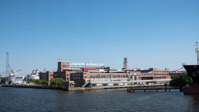
Patrick Sisson reported on Port Covington in detail in 2017, placing custody of the aspirations for the project in the hands of Kevin Plank, billionaire owner of Sagamore Development and Under Armour, and a native of Baltimore. Goldman Sachs is also an investor in the project.
"Located on the Patapsco River, this new city-within-a-city is viewed by many backers and Baltimoreans as a catalyst to raise the city’s profile and build a 21st-century economy," according to Sisson in 2017. "[The project] includes 2.5 miles of restored waterfront, 40-plus acres of new parks, 14.1 million square feet of mixed-use development on 235 acres spread across 45 city blocks, a new 3.9-million-square-foot Under Armour global headquarters, a light-rail station, and a score of next-generation manufacturing centers and startup spaces," reports Sisson.
In 2017, the city was already betting on the project to the tune of a $135.9 million benefit agreement and a $660 million Tax Increment Financing deal.
In 2019, however, a mapping error shifted Port Covington's census tract to eligibility for potentially millions in tax breaks as part of the Opportunity Zone program. According to the investigative work by Ernsthausen and Elliott the origina sotyr of Port Covington's Opportunity Zone designation has been revealed:
The Treasury Department released a list of census tracts across the country that were sufficiently poor to be included in the program. Port Covington was not included in that list.
Three weeks later, however, things turned around. The Treasury Department issued a revised list. The agency said it had left out some tracts in error. The revised list included 168 new areas across the country defined by the agency as “low-income communities.”
This time, Port Covington made the cut.
It couldn’t have qualified because its residents were poor. It couldn’t qualify because it was next to some place that was poor. But the tract could qualify under yet another provision of the law. Some tracts could make the cut if they had fewer than 2,000 people and if they were “within” what’s known as an empowerment zone. That was a Clinton-era redevelopment initiative also aimed at low-income areas.
Port Covington wasn’t actually within an empowerment zone, but it is next to one. So how did it qualify? The area met the definition of “within” because the digital map files the Treasury Department used showed that Port Covington overlapped with a neighboring tract that was designated an empowerment zone, Treasury officials told ProPublica.
That overlap: the sliver of parking lot beneath I-395. That piece of the lot is about one one-thousandth of a square mile.
The designation all comes down to misalignment, and Plank and Goldman Sachs will reap the benefits. Still, according to the article, there's no evidence that Sagamore Development influenced the Treasury Department's decision.
FULL STORY: One Trump Tax Cut Was Meant to Help the Poor. A Billionaire Ended Up Winning Big.

Developers Rebrand Baltimore’s Port Covington Megaproject
The megaproject formerly known as Port Covington is now known as Baltimore Peninsula.

Transforming the Waterfront into Baltimore's 'Blue Green Heart'
Dutch design firm West 8 recently won a competition to rethink an 11-mile stretch of the Baltimore's waterfront, not to be confused with a $5.5 billion project to redevelop Port Covington.

Shuttered Baltimore Hotel Will Become Affordable Housing
The project will create 303 new workforce housing units in a former downtown hotel.

Montreal Mall to Become 6,000 Housing Units
Place Versailles will be transformed into a mixed-use complex over the next 25 years.

Planetizen Federal Action Tracker
A weekly monitor of how Trump’s orders and actions are impacting planners and planning in America.

DARTSpace Platform Streamlines Dallas TOD Application Process
The Dallas transit agency hopes a shorter permitting timeline will boost transit-oriented development around rail stations.

Study: 4% of Truckers Lack a Valid Commercial License
Over 56% of inspected trucks had other violations.

Chicago Judge Orders Thousands of Accessible Ped Signals
Only 3% of the city's crossing signals are currently accessible to blind pedestrians.

Philadelphia Swaps Car Lanes for Bikeways in Unanimous Vote
The project will transform one of the handful of streets responsible for 80% of the city’s major crashes.
Urban Design for Planners 1: Software Tools
This six-course series explores essential urban design concepts using open source software and equips planners with the tools they need to participate fully in the urban design process.
Planning for Universal Design
Learn the tools for implementing Universal Design in planning regulations.
City of Mt Shasta
City of Camden Redevelopment Agency
City of Astoria
Transportation Research & Education Center (TREC) at Portland State University
US High Speed Rail Association
City of Camden Redevelopment Agency
Municipality of Princeton (NJ)