After 12 days of walking the Portuguese Camino, the importance of many urban planning and development debates—from balanced growth to banning cars—became abundantly clear.


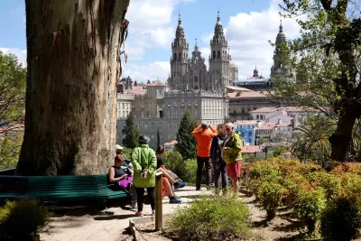
In order to understand places, built environment professionals and real estate developers need to also understand the places between, and practice on-the-ground, inter-urban, and inter-settlement walkability. This approach is an essential way to anticipate the context of a given site, using the “serial vision” pass-throughs once touted by urban design pioneer Gordon Cullen, and championed by Edmund Bacon in his still-worthwhile Design of Cities. In making similar assertions in my prior books and articles, I’ve also questioned whether technology-based journeys (whether by app or Google Street View) can really do this proposition justice by themselves.
After 12 days of walking the Portuguese Camino (Coastal and Litoral Routes) from Porto, Portugal to Santiago de Compostela, Galicia, Spain, I submit that this “serial vision” type of journey reveals even more holistic truths about today’s urban trends than previously imagined. For me, this journey became a research endeavor in its own right, intrinsically valuable to my work at the Centre for the Future of Places at the KTH Royal Institute of Technology in Stockholm, including a pending book on methods to sustain a city’s culture and character. In sum, for me, rather than a purely spiritual or athletic journey—typically the province of such Camino walks—this 10-20 miles per day hike became a chronicle of urbanist reflection.
The proposition about the importance of significant interstitial, or cross-community walks could easily fill books and lengthy articles, not only written by urbanists, but also by intrepid travel writers and tourism experts. Each is intriguingly motivated by the magic of observation and relative degrees of “authenticity” viewable by foot, when the car becomes relegated to a supplemental access tool. The act of entering and leaving cities, towns, and villages, as well as crossing "places between," not only highlights the virtues of walking itself (and lessening carbon emissions in the process), but also invokes the universal transitions between distinct locales and the amorphous rural countryside.
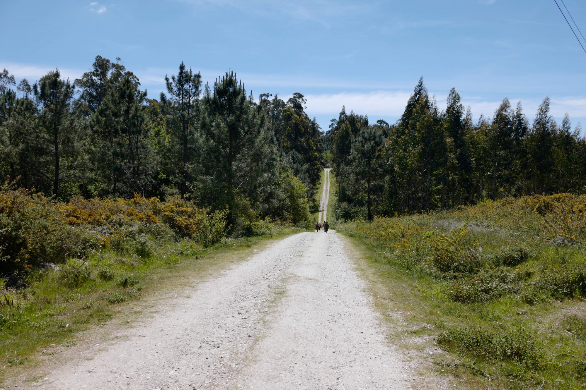
Understanding the readily apparent blends between built and natural, old and new—including how balances of uses change closer to clustered settlements—is key to defining sustainable cities going forward, and how they are monitored and interpreted. Writing from Santiago de Compostela after walking nearly 200 miles, here are some immediate and related post-journey propositions, by no means complete, but meant as a constructive baseline:
- I saw the roots and evolution of the transect concept. New Urbanists seized on this ecology-based notion long ago, and built new approaches to planning and zoning around the borrowed biological principle of the "transect." Between towns, it seems there is always a microcosm of similar characteristics defining the edges of urbanity. In addition, crossing from rural to urban environments (and vice-versa) several times over many days suggested that inter-urban walkability often resonates best along historical religious or military paths. These paths often linked towns that grew at a walkable distance from one another—unremarkably along a shore or in a river valley—routes where country became city or town along the way. These classic rural to urban transects showed artifacts of religion, active or fallow agriculture, and cemeteries that classically occur at the edge of town. Unfortunately, it was also clear that along the transect there was tangible waste from human activity today, often styrofoam or plastic-based, readily noticeable when passing by.
- I saw how places change, and the search for balance. The ebb and flow of nature, economic base and the passage of time are always ripe for observation. Why are some places passed by, and others appear both functional and alive? I repeatedly saw tourism as new economy of survival for some municipalities, and, at times, like around the world, alienating to local populations. In Santiago de Compostela, my wife and I discussed with local researchers a 5-year study underway to assess the impacts on the local population of the growing number of multi-route Camino walkers (grown from double-digits in the 1970s to over 300,000 today). Interestingly, display panels in Spanish evoked English translations suggesting that often, Santiago residents could not relate to the Camino tourism identity of their own town.
- I saw the organic basis for land use regulation. As suggested above, agriculture, cemeteries and abandoned or half-finished structures on the urban edge seemed to occur in the same relative locations again and again, framing a sort of organic zoning pattern mimicking the health and safety rationales that emphasize the “separation of use” rationale for today’s land use planning and regulatory tools.
- I saw the evolving role of religious buildings and property divisions. Likewise, religious structures remained convincingly definitional at periodic intervals. Sometimes their condition suggested that they are seldom-used, raising the question of how they can be reused in other ways as time passes. In another repeating pattern, fences and property divisions were preserved, with patterns of piled stones and recurring gates to nowhere. Some reflected properties that suggest owners moved to more prosperous places years ago.
- I saw what technology can and cannot do. An increasingly popular resource for Camino walking is, of course, smartphone apps. A Camino app is a walker’s Google Maps, Wikipedia and Expedia combined. They are helpful for planning and supplemental way-finding and mapping (but are not always up-to-date or accurate), and some help find accommodation along the way. But for a deep dive into understanding a changing urban and rural landscape, or for providing a serial interpretation of the world passing by, they were only corollary tools.
Where do these post-journey reflections conclude? Probably in my next book, as hinted above, but for now, in one comparison among many implied over the course of many days. I’ll always recall the contrast between the “don’t miss” Spanish city of Pontevedra, recently touted in The Guardian as a pioneering, “car-banning,” pedestrianized center—amid well-preserved buildings and provocative street furniture—versus the Portuguese coastal town of Póvoa do Varzim, with its own walkable streets and squares, surrounded by a discordant mix of building types and materials. In the latter, as I wrote 10 days ago to a more limited audience, a lifelong resident there mouthed the universal words of the person whose hometown had let him down.
This born and bred resident’s pride in his city was contagious—accumulated over some 40 years; he was an old-fashioned Good Samaritan, of the first order, as he directed us to an open store on Easter Sunday. But equally on display was his disappointment in his hometown of 65,000 people. He said things had gotten worse lately, and I asked him why. Too many new, tall buildings, he said, causing diminished access to light and air. To my urbanist distress, he did not seem to care about the economics of land development or how ubiquitous his sentiments might be in certain circles today.
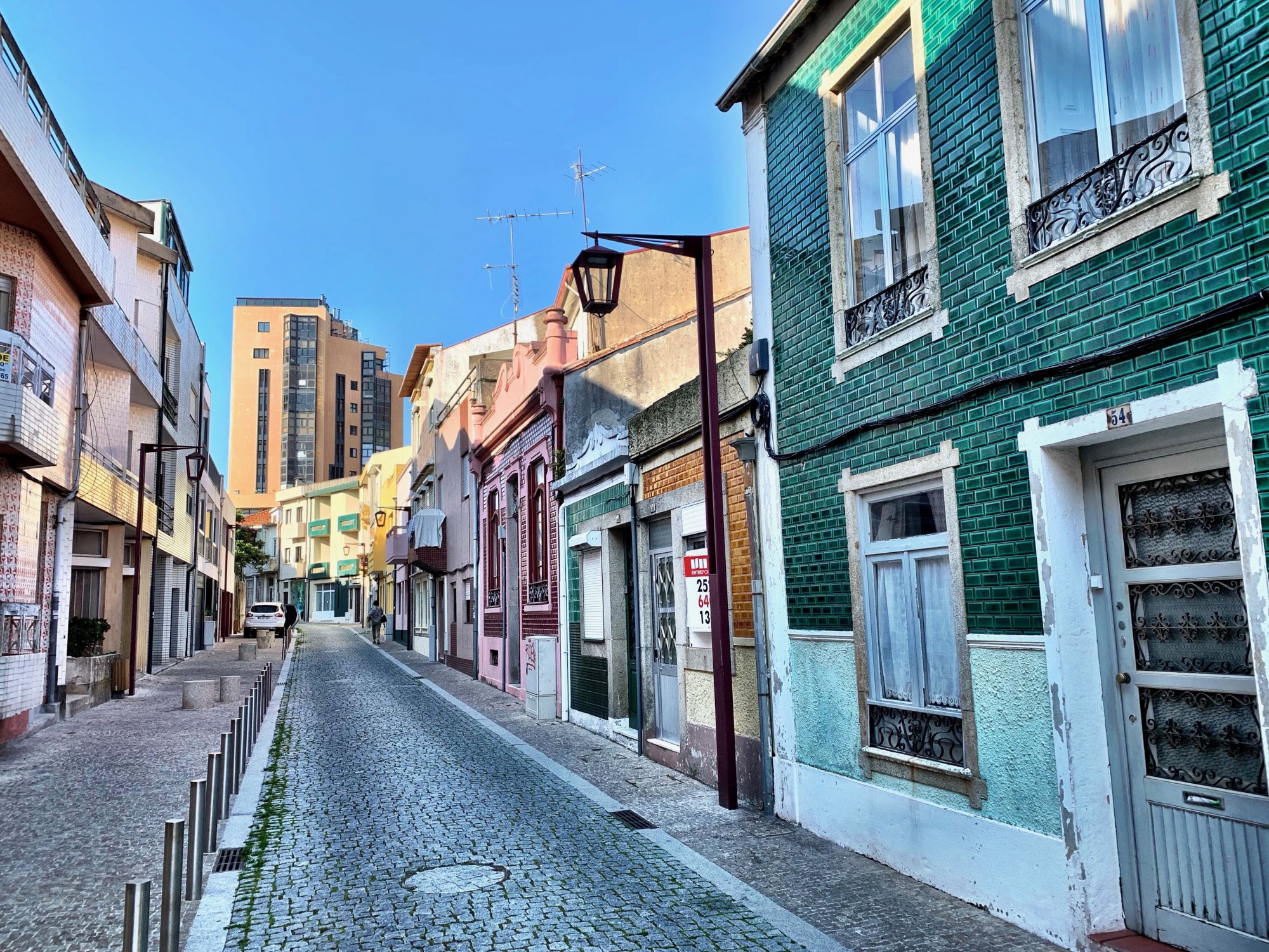
In comparison to what I saw and read about Pontevedra, all that mattered to the Good Samaritan of Póvoa do Varzim was something deeply personal; he maligned what he insisted was very detrimental change to the city he had known forever. So, this Portuguese Camino—a walk across places, time and changing environments reminded me of something essential. Where we live defines us and betrays us when our senses see unexpected change. We share this apparent betrayal with friends and neighbors, and even with strangers passing through.
In this case, as the stranger, I regret that I could offer nothing helpful, only that his disappointment was both global and familiar, as I had heard his story so many times before. A most Camino-like conclusion tells me that a long walk by those who make decisions about places might just show them—with purposeful capital letters—The Way.

Where Words Fail: Teach Architects and Urban Designers Like Violinists
Architects and urban designers justify or explain their work with words, and municipalities govern design with jargon-filled regulations. The outcome is often underwhelming.
Planning for Love, Part 3: Enhancing human connection through walkability
In the third and final installment of this series, author Hannah Kosoff examines what her research findings say about modern dating and urban form.
Planning for Love, Part 2: What happens to dating in a car-centric world?
A survey of over 150 adults about their dating lives reveals stark differences based on their neighborhood's walkability.

Planetizen Federal Action Tracker
A weekly monitor of how Trump’s orders and actions are impacting planners and planning in America.

The state-sanctioned urbicide of Austin
People don’t kill cities. Freeways do.
Colorado’s Largest Data Center Could Rise Next to Homes — Without a Public Hearing
The proposed campus would consume 11 times the power of Denver International Airport; as it has across the country, opposition mounts.

Nation's most wind-powered state turns to coal as data centers increase energy demand
For the first time in decades, Iowa has increased its generation of coal power.

NYC cools commuters with city's first rain garden above a bus stop
New York City officials say the plants in the rain garden can absorb 16 gallons of rainwater during heavy storms.

Brightline West’s future may rely on $6 billion federal loan
The company has until Nov. 2 to make a $400 million equity investment into its proposed high-speed rail line.

FREE Course: Walkable City 1: Why Walkability?
After describing his path towards focusing on walkability as the essence of good planning, Jeff Speck marches through his five principal reasons for making more walkable places.
Reinventing Malls: Planning Alchemy—Turning Gray Fields Into Gold
The course focuses on the opportunities and imperatives that shape reinvention of mall sites.

Greater Baltimore Committee
Eagle County Government
Harvard University Graduate School of Design
The Architects Foundation
University of Cincinnati Online
The Pocatello Development Authority
The Urban Renewal Agency of the City of Pocatello
Journal of the American Planning Association

