


Laneway development throughout the city is ramping up with new construction and public space projects.
Emily Mathieu reports that efforts to develop laneways are happening across Toronto as a way to increase available housing and density:
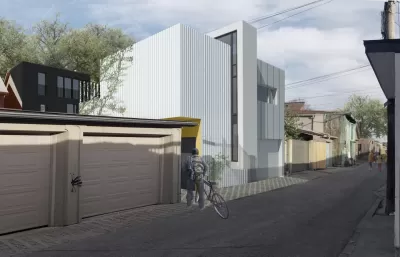
Laneway housing is a bit of a new frontier in terms of urban development — one that’s beginning to gain traction in Toronto after council passed regulations last summer allowing homeowners to convert garages and build up unused space into suites. The rules state the houses must be self-contained and can be rented out or used to provide a home for family members, but not sold off as a separate property.
In addition to housing, advocacy groups such as the Laneway Project want to see laneways better utilized as public spaces with shops, events, and public art. "Some Toronto laneways are already well used as public space, including Graffiti Alley, where street artists have transformed the backsides of Queen St. W. buildings, between Spadina Ave. and Portland St.," writes Mathieu.
There are concerns, however, about design and management of laneways for use by vehicles, cyclists, and pedestrians. Advocates say signage, signals, and improved lighting will make the laneways safer for all users sharing the space and ensure that residents and trucks still have access to homes and businesses.
FULL STORY: Laneway housing begins to take shape under Toronto’s new rules


Editorial: Toronto’s Snow Clearing Plan Isn’t Fair
The city’s plan for dealing with snow and ice on sidewalks this winter doesn't address past problems and won't meet the needs of residents, say critics.
Toronto Sets More Ambitious Climate Change Goals
The city is considering a proposal to reduce greenhouse gas emissions even more by aiming for carbon neutrality by 2050.
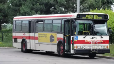
Toronto Could Give Buses and Streetcars Priority
In a shift away from subway expansions and upgrades, Toronto looks to improve the bus and streetcar systems.

Montreal Mall to Become 6,000 Housing Units
Place Versailles will be transformed into a mixed-use complex over the next 25 years.

Planetizen Federal Action Tracker
A weekly monitor of how Trump’s orders and actions are impacting planners and planning in America.

DARTSpace Platform Streamlines Dallas TOD Application Process
The Dallas transit agency hopes a shorter permitting timeline will boost transit-oriented development around rail stations.

Without International Immigrants, the Rural US Population Would Be Falling 58%
Census data shows that population growth in rural areas is due in large part to international migrants.

Dead End: Nine Highways Ready for Retirement
The Freeways Without Futures report describes the nation’s most promising highway removal proposals.

Congressman Proposes Bill to Rename DC Metro “Trump Train”
The Make Autorail Great Again Act would withhold federal funding to the system until the Washington Metropolitan Area Transit Authority (WMATA), rebrands as the Washington Metropolitan Authority for Greater Access (WMAGA).
Urban Design for Planners 1: Software Tools
This six-course series explores essential urban design concepts using open source software and equips planners with the tools they need to participate fully in the urban design process.
Planning for Universal Design
Learn the tools for implementing Universal Design in planning regulations.
City of Mt Shasta
City of Camden Redevelopment Agency
City of Astoria
Transportation Research & Education Center (TREC) at Portland State University
City of Camden Redevelopment Agency
Municipality of Princeton (NJ)
Regional Transportation Commission of Southern Nevada