


A network of monitoring devices will bring together technology and data analytics to help inform residents about air pollution.
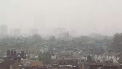
A new project called Breathe London will use stationary and mobile detectors to measure air quality throughout the city, reports Jenny Anderson:
The network will put 100 new fixed sensor pods in pollution hotspots and places where kids congregate, such as schools and nurseries. Sensors affixed to two Google view street cars will measure pollution about every 30 meters (98 feet), documenting pollution hotspots in real time for a year where fixed sensors cannot.
Children are especially vulnerable to the health effects of air pollution, and Mayor Sadiq Khan launched the Breathe London program at a school where almost a third of students have asthma.
The data gathered will be available on an interactive online map showing pollution sources and patterns and the impacts of factors such as weather and street design. "Armed with the data those monitoring systems provide, citizens particularly at risk will know what parts of the city to avoid, and policy makers will know where to concentrate efforts to reduce air pollution," notes Anderson.
FULL STORY: London is trying to make itself less toxic to kids


Study: London ULEZ Rapidly Cleaning up Air Pollution
Expanding the city’s ultra low-emission zone has resulted in dramatic drops in particle emissions in inner and outer London.

The London Subway Is Bad for Commuters' Lungs
A new study from the University of Surrey produced counterintuitive results about the relative pollution levels of commuters around London.

Colorado Landfills Emit as Much Pollution as 1M Cars
Landfills are the third-largest source of methane pollution in Colorado, after agriculture and fossil fuel extraction.

Maui's Vacation Rental Debate Turns Ugly
Verbal attacks, misinformation campaigns and fistfights plague a high-stakes debate to convert thousands of vacation rentals into long-term housing.

Planetizen Federal Action Tracker
A weekly monitor of how Trump’s orders and actions are impacting planners and planning in America.

In Urban Planning, AI Prompting Could be the New Design Thinking
Creativity has long been key to great urban design. What if we see AI as our new creative partner?

King County Supportive Housing Program Offers Hope for Unhoused Residents
The county is taking a ‘Housing First’ approach that prioritizes getting people into housing, then offering wraparound supportive services.

Researchers Use AI to Get Clearer Picture of US Housing
Analysts are using artificial intelligence to supercharge their research by allowing them to comb through data faster. Though these AI tools can be error prone, they save time and housing researchers are optimistic about the future.

Making Shared Micromobility More Inclusive
Cities and shared mobility system operators can do more to include people with disabilities in planning and operations, per a new report.
Urban Design for Planners 1: Software Tools
This six-course series explores essential urban design concepts using open source software and equips planners with the tools they need to participate fully in the urban design process.
Planning for Universal Design
Learn the tools for implementing Universal Design in planning regulations.
planning NEXT
Appalachian Highlands Housing Partners
Mpact (founded as Rail~Volution)
City of Camden Redevelopment Agency
City of Astoria
City of Portland
City of Laramie