


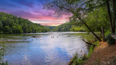
A comprehensive study to revitalize the Atlanta regional waterfront, dubbed the Chattahoochee RiverLands project, is now underway.
A joint planning effort by the city of Atlanta, Cobb County, the Atlanta Regional Commission (ARC), and the Trust for Public Land (TPL) is exploring ways to make the land along the Chattahoochee River more livable, workable, and playable for Atlanta and beyond. In SaportaReport, Walt Ray with TPL and Byron Rushing with ARC detail the intentions guiding the process.
The $1.5 million study deals with the length of the river from Buford Dam to Chattahoochee Bend State Park. That 100-mile stretch, divided among many jurisdictions, includes: city and county parks, state conservation lands, federal property, a sundry mix of trail authorities, and more. It's also governed by a variety of planning frameworks, including ARC's 2016 regional trails plan, Cobb County's 2017 trails plan, and Tim Keane's Atlanta City Design, adopted by the city in 2017.
The aim of the RiverLands project is to stitch all of those elements together to create what Rushing calls "a seamless public realm along the Chattahoochee River." One goal is to connect existing and new trails to the Silver Comet Trail, suburban communities, and MARTA stations. Others include driving economic development, restoring ecological habitat, and increasing public access to open green space.
FULL STORY: The Future Begins Now: An Update on the Chattahoochee River Master Planning Process

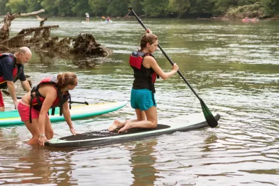
Riverfront Trail Takes Shape in Atlanta
Open space and mixed-use developments could make the Chattahoochee River, where it runs along the border of Atlanta, more accessible. A proposed trail along the river took a tangible step forward recently.

How South LA Green Spaces Power Community Health and Hope
Green spaces like South L.A. Wetlands Park are helping South Los Angeles residents promote healthy lifestyles, build community, and advocate for improvements that reflect local needs in historically underserved neighborhoods.
Comment: EPA Cuts will Send Atlanta Back to Eye-burning Ozone, Lung-damaging Smog, and Raw Sewage in the Chattahoochee River
A veteran political journalist takes stock of the hard-earned ground Georgia stands to lose with slashed environmental protection.

Planetizen Federal Action Tracker
A weekly monitor of how Trump’s orders and actions are impacting planners and planning in America.

Maui's Vacation Rental Debate Turns Ugly
Verbal attacks, misinformation campaigns and fistfights plague a high-stakes debate to convert thousands of vacation rentals into long-term housing.

San Francisco Suspends Traffic Calming Amidst Record Deaths
Citing “a challenging fiscal landscape,” the city will cease the program on the heels of 42 traffic deaths, including 24 pedestrians.

Amtrak Rolls Out New Orleans to Alabama “Mardi Gras” Train
The new service will operate morning and evening departures between Mobile and New Orleans.

The Subversive Car-Free Guide to Trump's Great American Road Trip
Car-free ways to access Chicagoland’s best tourist attractions.

San Antonio and Austin are Fusing Into one Massive Megaregion
The region spanning the two central Texas cities is growing fast, posing challenges for local infrastructure and water supplies.
Urban Design for Planners 1: Software Tools
This six-course series explores essential urban design concepts using open source software and equips planners with the tools they need to participate fully in the urban design process.
Planning for Universal Design
Learn the tools for implementing Universal Design in planning regulations.
Heyer Gruel & Associates PA
JM Goldson LLC
Custer County Colorado
City of Camden Redevelopment Agency
City of Astoria
Transportation Research & Education Center (TREC) at Portland State University
Jefferson Parish Government
Camden Redevelopment Agency
City of Claremont