


A new map shows where privately owned public spaces are located to encourage more public use.

In 1961, New York City started its program for privately owned public spaces (POPS), which gave private developers bonus floor area or waivers in exchange for providing and maintaining publicly accessible spaces on their properties. Over 550 of these POPS exist in the city today, with most located in Manhattan. However, the number of POPS in other boroughs throughout the city is increasing.
Although POPS are available for the public to use, the city has found that they are not as accessible as they should be. “While the city is home to hundreds of POPS, most people are unaware of their existence or location, and in many cases buildings were found to be in violation of the POPS laws, and restrict access to the public,” reports Tanay Warerkar.
To better inform the public, the New York City Department of City Planning has put together an interactive map of the city’s POPS. In addition to each site’s location, the map details amenities, hours of access, and information about the building. Today’s POPS are mainly public plazas and arcades, and the city hopes that more awareness of these urban spaces will lead to an increase in their use.
FULL STORY: Handy new map shows all of NYC’s privately-owned public spaces

Contest: Design a Logo for New York's Privately-Owned Public Spaces
New York City is holding a competition for a distinctive logo to clearly demarcate all of its 550 privately-owned public spaces.
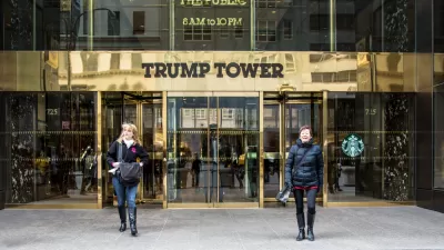
Report: Trump Tower Among Many NYC Buildings Not Maintaining Privately Owned Public Spaces
It's no secret that building owners often fail to maintain privately owned public spaces with any priority on the public part of that equation. A new report reveals just how widespread the problem is in New York.
The Not-So-Public Legacy of New York's Privately Owned Public Spaces
More and more often, barriers have been erected between the public and POPS, as privately owned public spaces are known.

Planetizen Federal Action Tracker
A weekly monitor of how Trump’s orders and actions are impacting planners and planning in America.

San Francisco's School District Spent $105M To Build Affordable Housing for Teachers — And That's Just the Beginning
SFUSD joins a growing list of school districts using their land holdings to address housing affordability challenges faced by their own employees.

The Tiny, Adorable $7,000 Car Turning Japan Onto EVs
The single seat Mibot charges from a regular plug as quickly as an iPad, and is about half the price of an average EV.

With Protected Lanes, 460% More People Commute by Bike
For those needing more ammo, more data proving what we already knew is here.

In More Metros Than You’d Think, Suburbs are Now More Expensive Than the City
If you're moving to the burbs to save on square footage, data shows you should think again.

The States Losing Rural Delivery Rooms at an Alarming Pace
In some states, as few as 9% of rural hospitals still deliver babies. As a result, rising pre-term births, no adequate pre-term care and "harrowing" close calls are a growing reality.
Urban Design for Planners 1: Software Tools
This six-course series explores essential urban design concepts using open source software and equips planners with the tools they need to participate fully in the urban design process.
Planning for Universal Design
Learn the tools for implementing Universal Design in planning regulations.
Smith Gee Studio
City of Charlotte
City of Camden Redevelopment Agency
City of Astoria
Transportation Research & Education Center (TREC) at Portland State University
US High Speed Rail Association
City of Camden Redevelopment Agency
Municipality of Princeton (NJ)