Cities with low road safety rankings are overwhelmingly newer and located in the South and Southwest.


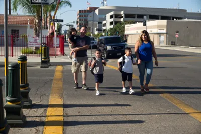
The newest U.S. Safe Streets Index published by the transportation analytics firm StreetLight found Sunbelt cities in the South and Southwest to have some of the worst road safety, reports J.K. Trotter in Streetsblog USA.
According to Trotter,
“New York City came in first and Bakersfield, California came in last — and towards the bottom of that range are a lot of southern cities.”
The analysis notes that, in most of the cities at the bottom of the list, “Vehicle miles traveled exposure tends to be high, and there is also heavy speed risk on pedestrian heavy roadways, which may be linked to wider arterials and higher-speed corridors.” It also points out that the safest cities, with some exceptions, tend to be some of the oldest, whose street networks were developed before the rise of the automobile and car-centric planning.
Ultimately, “Northern coastal metros may perform better in the Safe Streets Index due to their density and transit-oriented infrastructure, which helps limit miles driven, the highest-weighted factor in the analysis.” Dense cities reduce risk by simply lowering driving exposure.
Cities vary across the five metrics used by StreetLight for the analysis. “Streetlight ranked Los Angeles 96th out of 100 in terms of speed differential risk. But it also ranked L.A. fifth out of 100 for residential speeds.” Portland, Oregon ranks close to the top overall, but falls outside the top third for truck activity per capita.
Read the full story: Sunbelt Cities Rank Last in National Street Safety Index

Opinion: What American Transportation Engineering Gets Wrong
And how transportation decisions could more effectively prioritize safety.
In Defence of Vision Zero — a Traffic Engineer’s Perspective
Traffic engineers have long suffered the reputation that all we care about is moving cars. The reality could not be more different.
Spokane Updates its Complete Streets Policy
Mayor Lisa Brown signed a revised version of the city’s Complete Streets framework that more closely aligns with state law and the city’s municipal code.

Planetizen Federal Action Tracker
A weekly monitor of how Trump’s orders and actions are impacting planners and planning in America.

California plans to bury El Niño’s downpour
If the state plays its cards right, it may be able to store a billion acre-feet of El Niño’s water in aquifers.

Desperate measures: Advocates weigh draining Lake Powell to fill Colorado River
Draining the reservoir could reduce evaporation losses by a couple hundred thousand acre-feet.

California city breaks ground on transit connector
The project includes three mobility hubs and a pedestrian bridge.

After public outcry, Massachusetts city releases housing development tracker
Cambridge’s tracker currently shows 250 housing projects in various stages of development.

40 years after approval, Chicago breaks ground on new park
The park honors Jean Baptiste Point du Sable, the city’s first permanent non-native settler.

FREE Course: Walkable City 1: Why Walkability?
After describing his path towards focusing on walkability as the essence of good planning, Jeff Speck marches through his five principal reasons for making more walkable places.
Reinventing Malls: Planning Alchemy—Turning Gray Fields Into Gold
The course focuses on the opportunities and imperatives that shape reinvention of mall sites.

City of Rosemead
Rutgers University, Edward J. Bloustein School of Planning and Public Policy
One Hundred Miles
Hunter College, City University of New York (CUNY)
The Architects Foundation
University of Cincinnati Online
City of Cambridge
Montrose County
The Pocatello Development Authority