


The city is raising shorelines and building protective gates to prevent future flooding and storm surges from impacting residents.

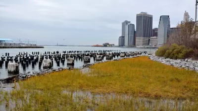
New York City celebrated the completion of the first section of a coastal flood barrier on the Lower East Side. The 2.4-mile East Side Coastal Resiliency (ESCR) project is designed to protect roughly 110,000 LES residents from a projected ‘100-year’ storm.
According to an article in CityLand, “The East Side Coastal Resiliency adds two feet of elevation should sea levels rise through raised parkland, floodwalls, berms, and 18 swinging or sliding flood gates. In February 2022, the first floodgate was installed in the northern section.”
According to Mayor Eric Adams, the project was finished “two months ahead of schedule and $10 million under budget.” Together with the Brooklyn Bridge-Montgomery Coastal Resilience, the project will protect 3.22 miles of urban shoreline from storm surges and flooding.
FULL STORY: City Celebrates Completion of First Part of East Side Coastal Resiliency Project


New York Flood Control Plan Takes Lessons From the Dutch
The Netherlands has a long history of flood mitigation. U.S. cities, threatened by coastal flooding and erosion, are taking note.
Shift in Direction of New York Resiliency Project Raises Questions
After delays and a groundbreaking that still has not happened, proposed changes to New York’s big resiliency project have not been well received.

Battery Park Resilience Project Breaks Ground
By 2027, the shoreline will be elevated by 5 feet to prevent flooding from future storm surges.

Maui's Vacation Rental Debate Turns Ugly
Verbal attacks, misinformation campaigns and fistfights plague a high-stakes debate to convert thousands of vacation rentals into long-term housing.

Planetizen Federal Action Tracker
A weekly monitor of how Trump’s orders and actions are impacting planners and planning in America.

In Urban Planning, AI Prompting Could be the New Design Thinking
Creativity has long been key to great urban design. What if we see AI as our new creative partner?

King County Supportive Housing Program Offers Hope for Unhoused Residents
The county is taking a ‘Housing First’ approach that prioritizes getting people into housing, then offering wraparound supportive services.

Researchers Use AI to Get Clearer Picture of US Housing
Analysts are using artificial intelligence to supercharge their research by allowing them to comb through data faster. Though these AI tools can be error prone, they save time and housing researchers are optimistic about the future.

Making Shared Micromobility More Inclusive
Cities and shared mobility system operators can do more to include people with disabilities in planning and operations, per a new report.
Urban Design for Planners 1: Software Tools
This six-course series explores essential urban design concepts using open source software and equips planners with the tools they need to participate fully in the urban design process.
Planning for Universal Design
Learn the tools for implementing Universal Design in planning regulations.
planning NEXT
Appalachian Highlands Housing Partners
Mpact (founded as Rail~Volution)
City of Camden Redevelopment Agency
City of Astoria
City of Portland
City of Laramie